The Northern High Latitudes Are More Flammable
We not only have the melting ice to worry about. We also have to stress about the opposite: fire. According to the Arctic Report Card, rising surface temperatures in Northern Hemisphere high latitudes have made fire fuels—organic matter on the ground or above the surface such as trees and peat that will ignite and burn—more flammable over the past 41 years.
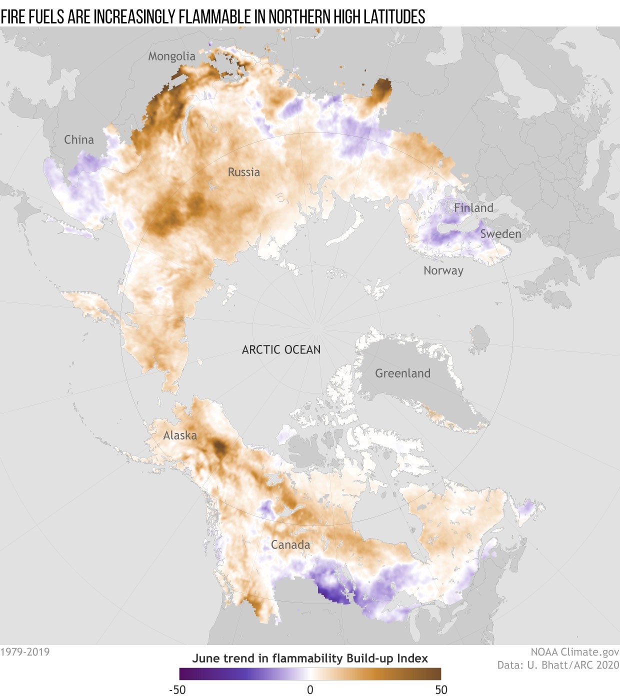
You can see this clearly in the graphic above, which shows the buildup index trend in June from 1979-2019. Brown indicates increasing flammability, while purple indicates decreasing flammability. The buildup index is an element of the Canadian Forest Fire Danger Rating System. It consists of a numerical rating of fuel available to catch fire and considers surface temperature, relative humidity, and 24-hour rainfall totals.
When the buildup index reaches certain levels, fires can burn more aggressively and intensely. The graphic indicates that the widespread increase in the buildup index in June at higher latitudes in both North America and Asia reflects that conditions are becoming more favorable for fire growth. Trends in the availability of dry, flammable fuels for wildfire growth are consistent with what we’ve seen on the ground in recent years as well as projections for the next century. Multiple climate scenarios project that there could be up to a fourfold increase in burned area across the higher northern latitude ecosystem by 2100.


