Perseverance’s path
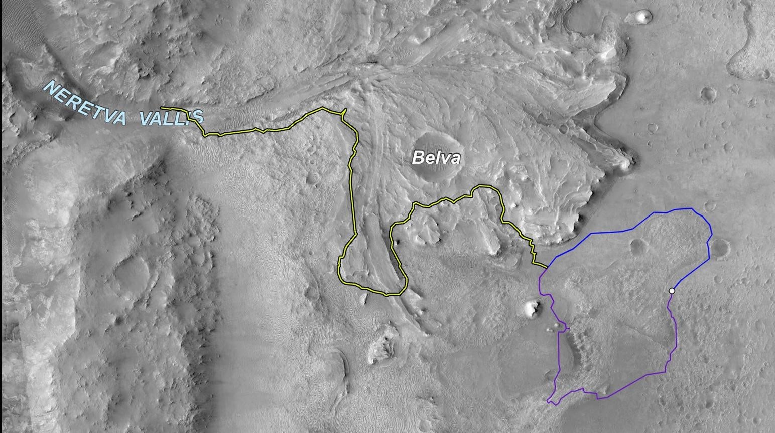
This map shows two paths NASA’s Perseverance team charted for the rover from its landing site (white dot at right). The rover ended up taking the blue path, and now sits at the base of the raised river delta at the center of the image. The delta is thought to have carried water from the west into the lake that occupied Jezero Crater, at right.