Our first view of the depleting ozone layer
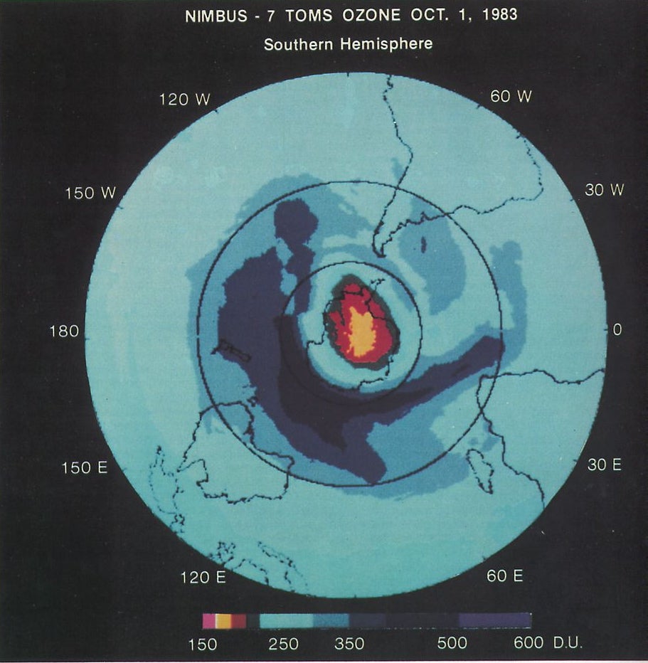
The discovery of the ozone layer hole in 1985, rightfully described as a black swan event (an unpredictable event with widespread consequences), was made possible by the Total Ozone Mapping Spectrometer (TOMS) on the NASA/NOAA Nimbus-7 satellite.
At a pivotal meeting in Prague, Czechoslovakia, in August 1985, atmospheric scientist Pawan Bhartia unveiled this satellite-based image that, for the first time, showcased the vast scale of the Antarctic ozone hole. This upsetting revelation transformed our understanding of the Earth’s atmosphere and its vulnerabilities, catalyzing global action that culminated in the 1987 Montreal Protocol—an international agreement to eliminate substances that deplete the ozone layer. NASA satellites continue to monitor the ozone hole, offering crucial data on this critically important atmospheric phenomenon.