The Pacific Northwest Gets Hosed by an Atmospheric River
The Pacific Northwest had such a wild year of weather, it made the list twice. La Niña conditions formed in fall, setting the stage for wetter-than-normal conditions in the region. While La Niña raises the odds of more rain, it doesn’t guarantee heavy precipitation. But this year has, so far, delivered.
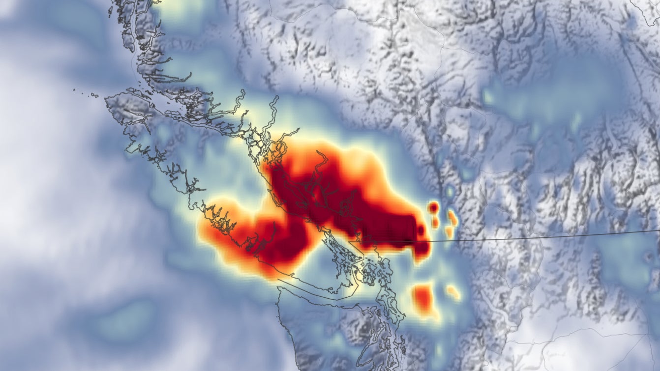
The heavy rain that fell in mid-November did so on slopes charred by wildfires and prone to mudslides and debris flows. Farmers used jet skis to rescue cattle, and at one point, Vancouver was cut off from the rest of Canada. It was such an epic deluge that November essentially broke rainfall scales for weather maps on the U.S. side of the border. The rest of the season looks to continue the trend of wetter weather than normal, so more satellite views like this could be forthcoming.


