Devastation Seen From Space
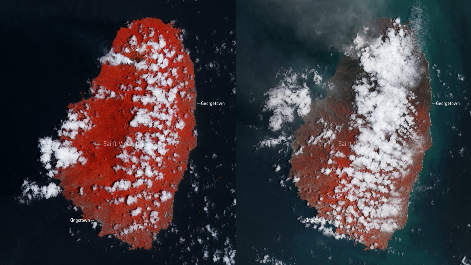
The European Space Agency released satellite images on Friday captured by the Copernicus Sentinel-2 mission showing a before-and-after of the island blanketed in the ash cloud, with the red areas representing plant density. In the second image, much of the formerly red areas are now darkened by ash. NASA’s Earth Observatory is also tracking the ash plume from La Soufrière, which its Terra satellite measured at an altitude of 12 miles (20 km). Winds have carried ash and debris to islands near St. Vincent, including Barbados, Grenada, and Saint Lucia.