Canada is currently experiencing one of its worst wildfire seasons ever. The active fires blazing in British Columbia, the Northwest Territories, and Alberta are spewing tremendous amounts of smoke into the atmosphere, affecting weather patterns in both Canada and the United States.
This gorgeous shot was taken by the NOAA’s GOES-west satellite on July 9, 2014. The brownish-colored haze created by forest fires in Canada’s NWT have drifted as far as South Dakota. Fires in the NWT are cumulatively occupying a space nearly as large as Texas. Fire danger remains high throughout much of Canada, and evacuation orders are in effect for many communities.
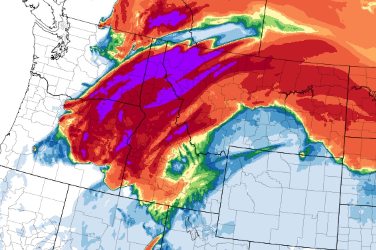
These maps from the Canadian Wildland Fire Information System show the extent of the problem.
Above: Fire danger (blue is low, red is extreme). Below, active fires (the purplish blobs represent fires greater than 1,000 hectares).
[ NASA ]
Top image: NASA/NOAA GOES Project, Dennis Chesters. Caption: NASA Goddard, Rob Gutro