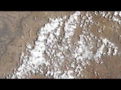
Get ready to take a trip. Your 6,000 mile (9,000 km) long journey will start in Russia and extend down to the northern tip of South Africa — and you’ll see it all from a height of 438 miles (705 km).
It’s called The Long Swath — a 19-gigapixel filmstrip of the Earth produced by NASA’s Landsat Data Continuity Mission (LDCM). Taken on April 19th, 2013, the satellite’s natural color imager surveyed a strip of land 120 miles (185 km) wide and 6,000 miles (9,000 km) long.
NASA says it’s an unusually long distance considering 70% of the planet is covered with water. The seamless 15-minute video was compiled from 56 still images.
NASA’s Earth Observatory site features the swath mosaic in GigaPan view, allowing you to use the controls to zoom in and navigate the gigantic image. Each still image is available for download.
Image: NASA Earth Observatory.