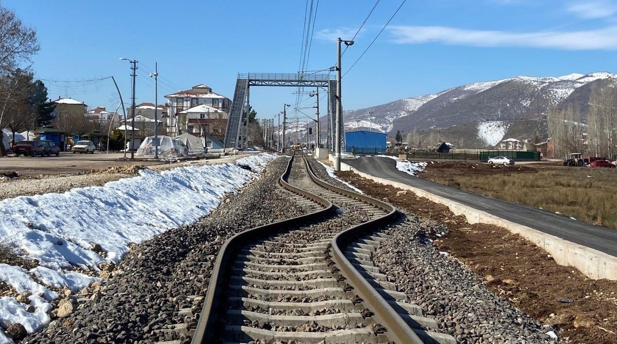
The earthquake that struck Turkey and Syria on February 6, 2023 caused widespread devastation and killed more than 50,000 people. Now, a team of geoscientists have released striking images and drone footage of the fault line that shifted the ground across the region, and used it to map how the quake started and spread.
Published today in the journal Science, the research details how ruptures on Earth’s surface propagated along the quake fault lines. The team notes that the initial quake occurred on the Dead Sea fault zone, but the largest quake happened when that energy moved to the East Anatolian fault zone. Click through to see their photos and videos of the unmistakable split that appeared with the disaster.