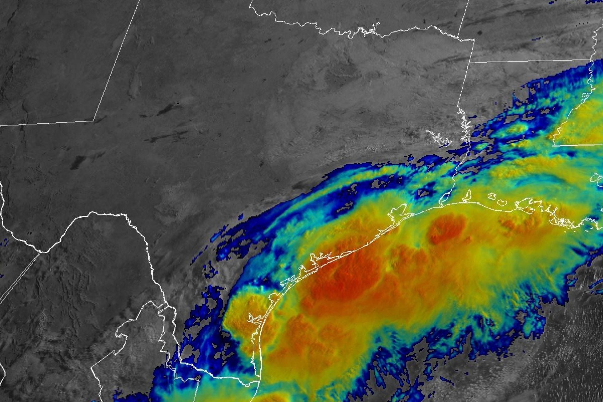
The National Hurricane Center is keeping a close eye on a disturbance over South Texas that could soon become the first tropical storm of the Atlantic hurricane season. Federal forecasters expect multiple days of heavy to “prolific” downpours to drench much of the South, bringing a “considerable flood threat” to the region.
As of 8 a.m. ET on Tuesday, the system was producing a large area of disorganized showers and thunderstorms centered over South Texas, according to the NHC. Forecasts show it tracking northeastward along the Texas coast and potentially emerging over the northwestern Gulf of Mexico by the afternoon or evening. There’s a 60% chance that this disturbance will organize into a tropical cyclone within the next 48 hours, but its development will depend on how long it lingers over warm Gulf waters, meteorologist Ben Noll reports for the Washington Post.
If the system does develop into a named storm, it will be called Arthur. But “[r]egardless of tropical cyclone formation, interests across southern and eastern Texas, southern portions of Louisiana and Mississippi should prepare for periods of intense rainfall over the next several days, which could produce widespread, life-threatening flash, urban, and river flooding,” the NHC stated in an update early Tuesday morning.
Atmospheric moisture levels will be *prolific* across the South this week, with the potential for flooding rain spreading across a corridor from Texas to the Carolinas.
In some areas, record-breaking precipitable water of 4 inches is forecast, signaling a waterlogged atmosphere. pic.twitter.com/tKuFyV8SLy
— Ben Noll (@BenNollWeather) June 15, 2026
An already deadly situation intensifies
The National Weather Service has issued flood watches stretching from South Texas across the southeastern portion of the state, most of Louisiana, and into south-central Mississippi. Over the next three days, the agency expects to see storm total rainfall amounts of five to seven inches (12.7 to 17.8 centimeters) and locally higher amounts along the Texas coastline into Louisiana.
By Friday, localized areas within the storm’s path could receive over a foot (30.5 centimeters) of rain, Noll reports. Cities bracing for its arrival include Houston, Texas; Lafayette, Louisiana; Jackson, Mississippi; Montgomery, Alabama; and Atlanta, Georgia.
This slow-moving storm is carrying copious amounts of tropical moisture, which explains why it is likely to cause flooding even if it doesn’t develop into a tropical cyclone. As all this moisture collides with a stalled cold front just inland of the Gulf Coast, it will trigger excessive rainfall regardless of storm organization.
We’re already seeing this play out in Texas, where flooding began on Monday from Austin to the Rio Grande Valley, San Antonio, and Waco, Noll reports. According to CNN Weather, rescue crews recovered the body of a woman whose vehicle was swept into a creek northwest of San Antonio early that morning, and there have been reports of water rescues in Texas and Louisiana since Sunday.
Texas Governor Greg Abbott issued a disaster declaration for 101 counties on Monday “to ensure that local officials and communities have access to the full range of state resources and support,” he said in a statement.
The South’s new normal
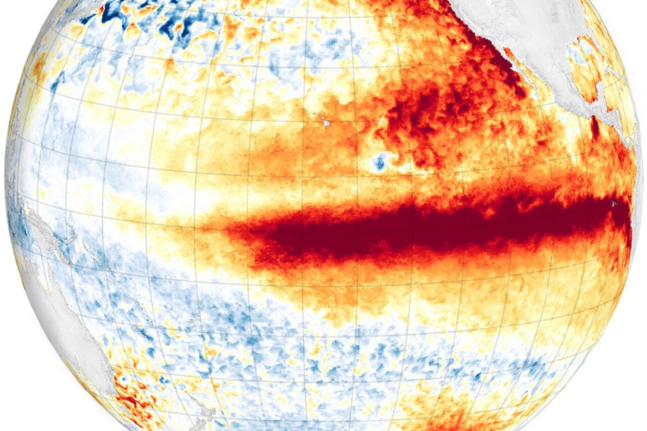
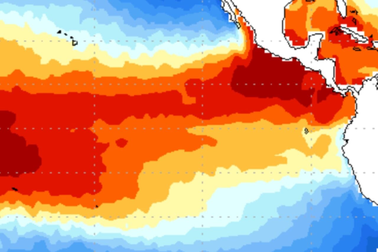
This could be the first of many life-threatening flood events in the South this year. El Niño, which officially developed in the Pacific last week, typically brings stormier weather and heavier precipitation to the South as the jet stream shifts southward. Forecasters believe this El Niño could become one of the strongest on record, and the stronger it is, the more significant its weather impacts could be.
At the same time, human-driven climate change is forcing the atmosphere to retain more moisture, making it easier for waterlogged storm systems like this one to take shape. From 1958 to 2012, the Southeast experienced a 27% increase in the amount of precipitation falling in very heavy events, according to the Environmental Protection Agency.
In recent years, such events have shown that major hurricanes aren’t the only storms that can have a catastrophic impact. In June 2025, a disorganized storm system overloaded with remnant moisture from Tropical Storm Barry triggered deadly flash floods in the Texas Hill Country, killing more people than the number of fatalities caused by freshwater flooding from Hurricane Helene.
As a strong El Niño unfolds against the backdrop of climate change, the South could face a particularly dangerous summer. States’ disaster preparedness and recovery systems will be put to the test this week, but they will need to be resilient as increasingly frequent, severe storms strain resources.