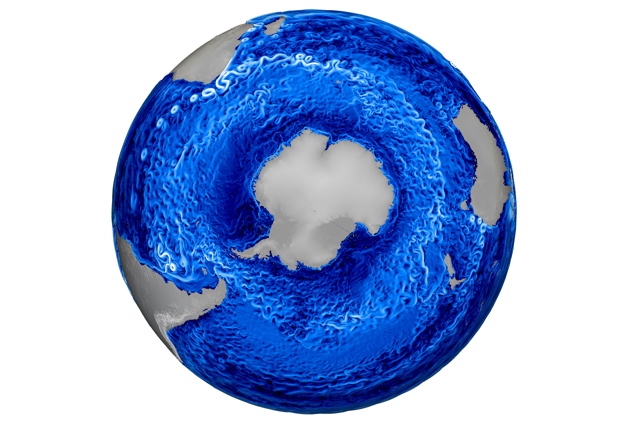
Researchers at the Los Alamos National Laboratory have created a highly detailed visualization showing ocean currents and eddies around the frozen Antarctic continent.
The high-res simulation, courtesy of the Lab’s MPAS-Ocean Model, includes 90 million grid cells ranging from 6 to 19 miles (10 to 30 km) in horizontal width. Colors are representative of current speed, where white is fast and blue is slow.
An extra-large version can be found here. Here are some close-up shots to get a sense of the incredible resolution:
A release from the Los Alamos National Laboratory explains what you’re seeing:
Detailed turbulent structures are visible throughout the Southern Ocean, where the Antarctic circumpolar current flows eastward around the globe. Large eddies are particularly visible in the Agulhas current at the southern tip of Africa. These ocean simulations are validated against satellite and shipboard observations.
Even though individual eddies occur on scales of 10-150 km, their cumulative effects have large and long-ranging consequences on the earth’s climate. In the Southern Ocean, eddies transport heat poleward. The strength of large-scale circulations in the northern hemisphere is sensitive to the turbulence in the Southern Ocean. Ocean models are used to test how these interactions may be altered in a changing climate.
It took a supercomputer running 8,000 processors to make this simulation possible.
Image credit: Los Alamos National Laboratory/MPAS-Ocean Model


