Satellite Imagery Shows the Spectacular Flow to the Sea
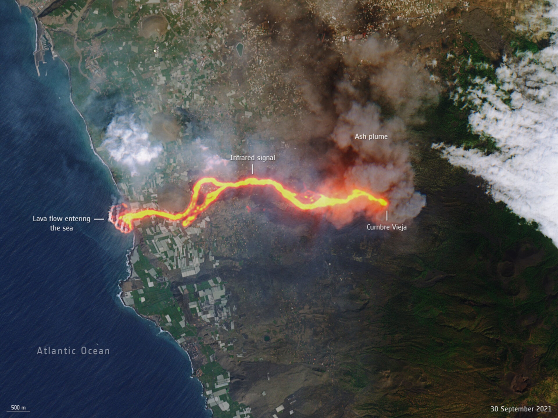
About that other lava flow. Imagery captured by the European Space Agency shows the trail of destruction it has left across the island. The agency released striking Copernicus-2 satellite imagery on Friday showing the stream of molten rock stretching nearly 4 miles (6 kilometers) from the Cumbre Vieja to the Atlantic Ocean.