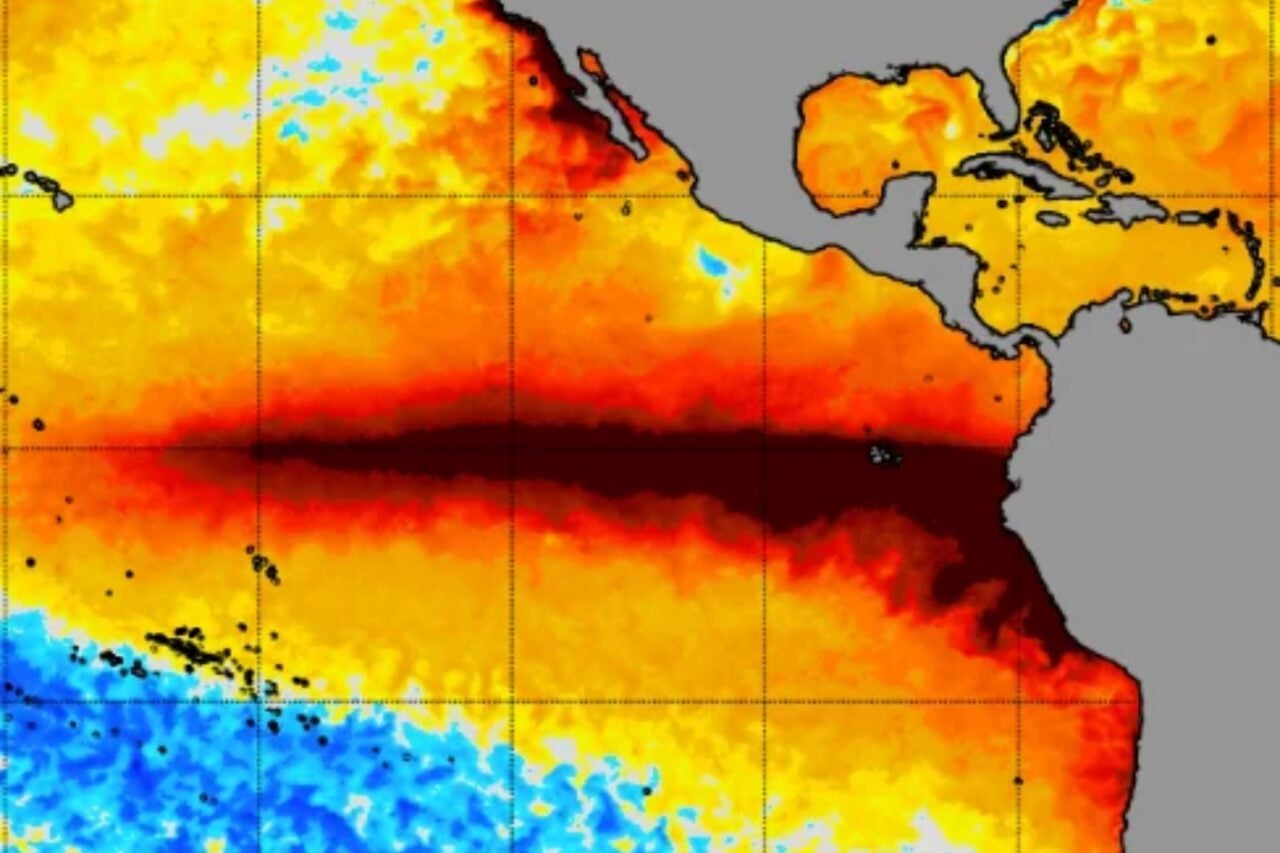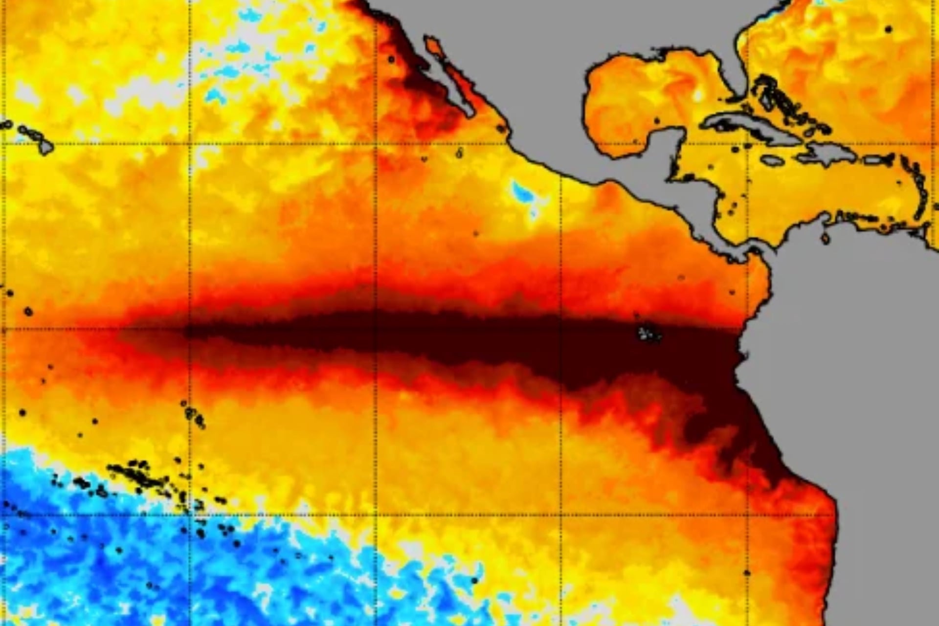
For months now, El Niño has been strengthening at breakneck speed. Climate scientists expect this event to reach a record-breaking peak sometime in December or January, so why are Pacific sea surface temperatures suddenly declining?
Take a look at this graph from the University of Maine’s Climate Change Institute. It charts daily average sea surface temperatures in the Niño 3.4 region, a key area of the central and eastern tropical Pacific that scientists monitor for El Niño and La Niña. That red line jutting out above all the rest is 2026, and as you can see, temperatures since June have been well above any observed in the last 45 years. That’s because of the current super El Niño.
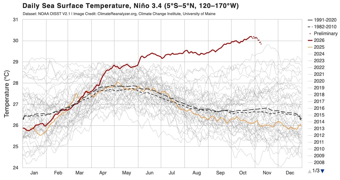
Over the past two weeks, however, sea surface temperatures in this Pacific region have appeared to fall. On Monday, the preliminary daily average was 0.63 degrees Fahrenheit (0.35 degrees Celsius) cooler than it was on October 30. This has sparked speculation that El Niño may have peaked early, but scientists beg to differ.
“Is El Niño peaking early? Probably not!” meteorologist Ben Noll wrote in an X post on Tuesday. “Of the new models just released, 5 of 10 show a peak in December, with 4 of 10 in January. There’s still huge amounts of warm water in the Pacific, with subsurface waters in the Niño 3.4 region even warmer than the surface in some areas.”
Is El Niño peaking early? Probably not!
Of the new models just released, 5 of 10 show a peak in December, with 4 of 10 in January.
There's still huge amounts of warm water in the Pacific, with subsurface waters in the Niño 3.4 region even warmer than the surface in some areas. pic.twitter.com/3z2QQIdqIb
— Ben Noll (@BenNollWeather) November 10, 2026
Climate scientist Daniel Swain of the University of California Agriculture Natural Resources agrees. “Contrary to many web rumblings, El Niño has probably *not* yet peaked despite a possible recent plateau in key Nino 3.4 region ocean temps, and we will likely see some further strengthening into Nov and Dec as ongoing strong westerly wind bursts continue in tropics,” he posted on X Tuesday.
Why does it look like El Niño is weakening?
There are a few things to consider when looking at the recent decline in Niño 3.4 sea surface temperatures. First and foremost is that all data points since October 28 are preliminary and subject to change pending confirmation from the National Oceanic and Atmospheric Administration.
Still, it’s entirely possible that sea surface temperatures have declined since late October, and that doesn’t mean the peak of El Niño has already come and gone. Sea surface temperatures are noisy and sensitive to multiple atmospheric and oceanic forces, not just El Niño. It’s not at all uncommon for them to fluctuate over relatively short periods. As the graph shows, multiple dips have occurred since May, when El Niño officially took hold of the tropical Pacific.
Noll points out that the central and eastern tropical Pacific is still holding on to an enormous amount of heat beneath the surface as well. That’s a good indication that El Niño will continue to strengthen as that heat rises to the surface. In other words, a lot more fuel in the tank for this event, so to speak. The westerly wind bursts Swain mentioned—sudden, temporary reversals of winds that typically blow east to west across the tropical Pacific—will facilitate El Niño’s continued intensification.
So, two weeks of declining sea surface temperatures in the Niño 3.4 region do not signal the start of a long-term decline. Indeed, climate models are still predicting that El Niño will peak in December or January. They show temperatures in the Niño 3.4 region topping out at roughly 7 degrees F (4 degrees C). That’s warmer than the peak of any El Niño in the modern meteorological record.
This potentially historic El Niño will increase the chances of extreme and anomalous weather across the globe, though its impacts will vary region by region. While it will be several more weeks until we can grasp the full scale of this event, scientists say now is the time to prepare.