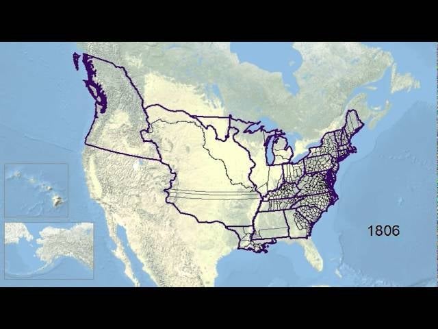
U.S. state and county boundaries have changed a lot since 1629. This wonderfully simple animation shows how they’ve been drawn and redrawn over almost 400 years.
Flowing Data points out that you can actually grab the data used to make the full animation below from the Newberry Library site if you’re feeling creative. Or just watch it on loop—that’s fun too. [YouTube via Flowing Data]