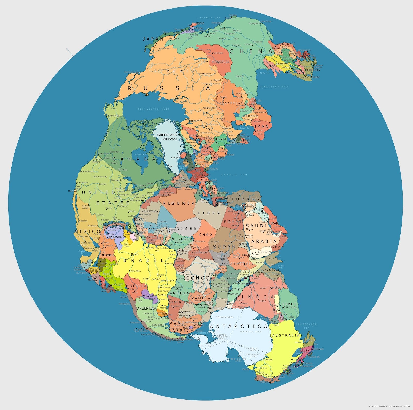
Pretty wild, right? It’s a map of Pangea — a supercontinent that formed roughly 300 million years ago — mapped with contemporary geopolitical borders.
What you see here is an anachronistic mashup — a modern map, complete with geological features that did not exist 300-million years ago, with its various parts relocated to the general position they would have occupied before Pangea began rifting apart some 200-million years ago. It’s a view of the supercontinent not often seen, and a mind-bending way of relating to the world on a geological time scale. [Hi-res]
Redditor LikeWolvesDo, who posted the image last week, stumbled across this particular interpretation of Pangea at this roundup of Pangea Maps. Unfortunately, the source link is dead, so neither of us was able to find the map’s true provenance. At the bottom corner of the image however, is a name – Massimo Pietrobon – and an email address; so, for the time being, we’re going to assume he’s the creator. We’ve reached out to Pietrobon, but have yet to receive a response. We’ll let you know if and when we do.
Edit: As ukuleledan points out in the comments, Pietrobon does, in fact, appear to be the map’s creator.
https://gizmodo.com/fairly-certain-that-is-the-creator-this-is-the-post-fr-510719267


