Move over, El Niño. You may be the strongest such climate pattern humans have ever recorded, and you may have given California crabs this week, but the National Oceanic and Atmospheric Administration can see right through you, and you’re losing ground.
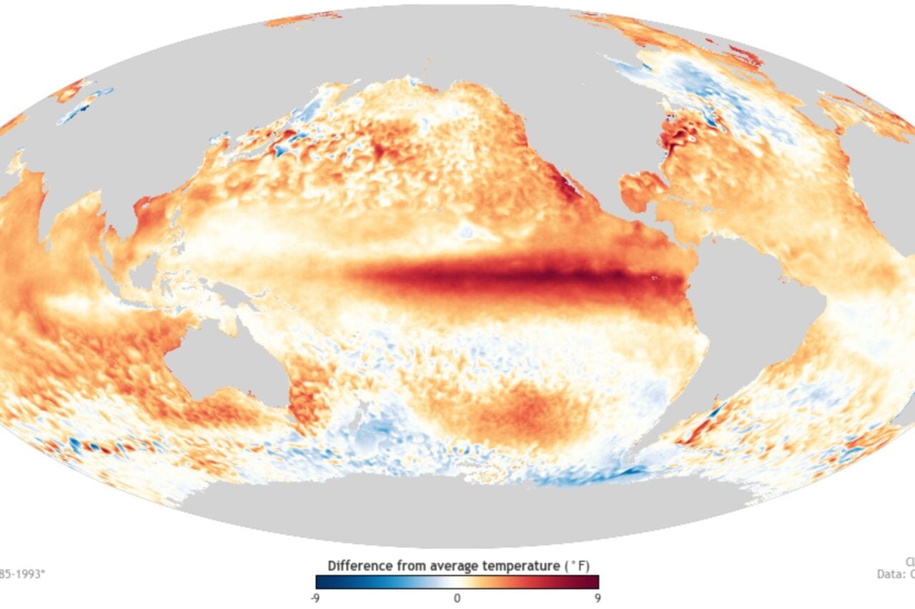
That’s right: the El Niño phenomenon that fueled endless weird weather, hot months, and Chris Farley jokes this past year is on the downswing. And if the latest NOAA data is any indicator, La Niña is liquored up and ready to rage. The Hot Blob that’s been cooling its heels over the Pacific for the past year—a constant reminder that we’re in the steamy clutches of a monster El Niño—is now being undercut by a deeper pool of colder water.
Cold Blob has been migrating eastward for the past few months, indicating that the La Niña phase of the ENSO climate pattern may develop by the end of summer.
https://gizmodo.com/el-nino-is-almost-over-but-anti-el-nino-is-on-its-wa-1759892435
The gif above, put together by NOAA’s Environmental Visualization Lab, shows us temperature anomalies (where temperatures were warmer or cooler than average) for three five day periods in March, April and May 2016. You can see that as the months go by, the hot water anomaly contracts as the icy undercurrent grows in size. Just in the past few weeks, Cold Blob has begun to breach the surface.
A La Niña this fall isn’t a surefire thing, but this latest climactic drama makes the anti-El Niño pattern more likely than ever. If La Niña does kick in, it could spell a break to our record run of hottest months in recorded history. We just experienced our seventh of those, by the way. La Niña is also associated with mild winters in the southeastern United States, cold winters in the Northwest, and favorable Atlantic hurricane conditions.
https://gizmodo.com/no-now-this-is-officially-the-hottest-earth-has-ever-b-1763550051
Still, the cool relief of La Niña is unlikely to stop 2016 from becoming the hottest year in recorded history. Even as opposing climate anomalies duke it out over the equatorial Pacific, humans now control the master switch when it comes to our planet’s thermostat.
[NOAA h/t Popular Science]

