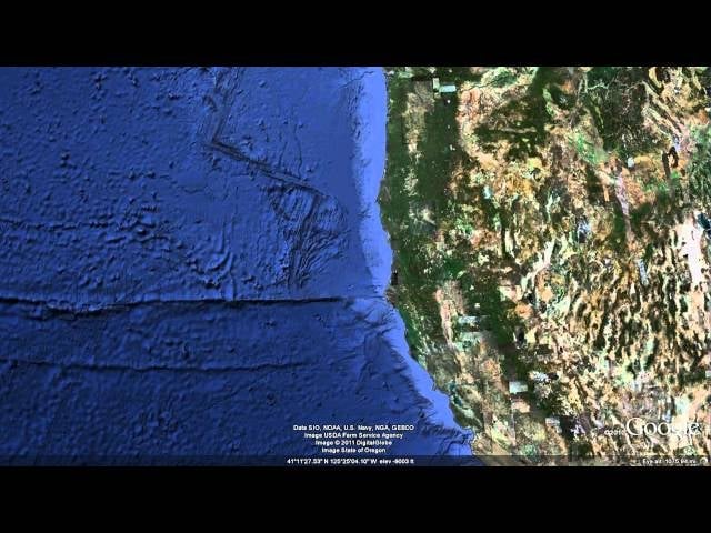
Rejoice, sea lovers and Cousteau wannabes, because Google Earth now allows you to explore the ocean seafloor. It’s quite the trip, even if it doesn’t cover the entire planet yet.
Explore the ocean seafloor with Columbia University’s Lamont-Doherty Earth Observatory Global Multi-Resolution Topography (GMRT) Synthesis covering half of all of the ocean that has ever been mapped, an area larger than North America. You can also view new data of Cordell Bank and the Gulf of the Farallones off of the California coast from California State University Monterey Bay (CSUMB) along with a beautiful 50 meter synthesis of the Hawaiian Islands from the University of Hawai’i at Manoa’s School of Ocean and Earth Science and Technology (UHM-SOEST).
I don’t know about you, but I’m headed to the Laurentian Abyss. One ping, Vassily. [Youtube via New Scientist]