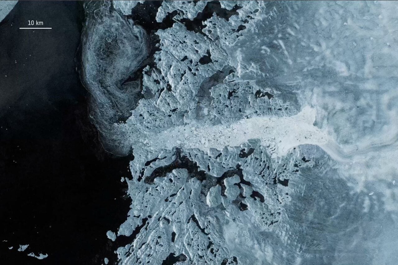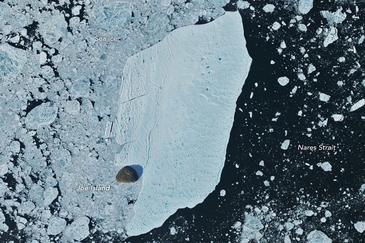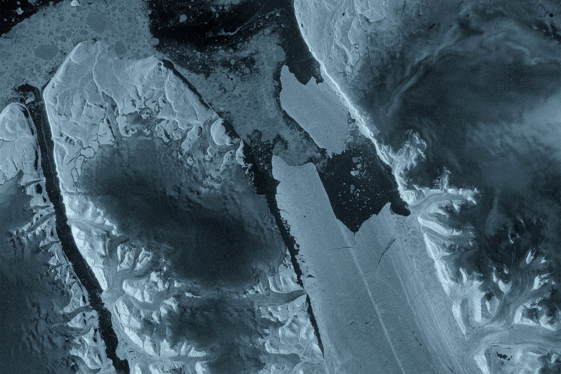
A massive slab of ice has broken away from one of Greenland’s largest remaining floating glacier tongues, creating a Manhattan-sized iceberg in the Arctic Ocean. The dramatic calving event at Petermann Glacier was captured by satellites in August, offering scientists a striking view from space of the glacier’s changing—and increasingly fragile—ice tongue.
The European Space Agency’s (ESA) Copernicus Sentinel-1 mission captured the vast ice island as it detached from the eastern side of the glacier on August 4. The newly released satellite imagery revealed fractures within the ice tongue months prior to the calving event.
The 29-square-mile (76-square-kilometer) section that broke free represents Petermann Glacier’s largest loss of floating ice in more than a decade. And while the breakup was years in the making, the sudden separation offers a powerful snapshot of the forces reshaping Greenland’s glaciers.
A close watch
Petermann is one of Greenland’s largest marine-terminating glaciers, which frequently sheds large icebergs and discharges them into the ocean.
Scientists have been relying on satellite imagery to monitor changes in the glacier since 2019. In April, observations revealed deformation and fractures that had started to develop within the ice tongue. Months later, Sentinel-1 radar imagery showed pronounced deterioration along the centerline of the ice tongue. The next day, the newly formed ice island had completely detached itself.
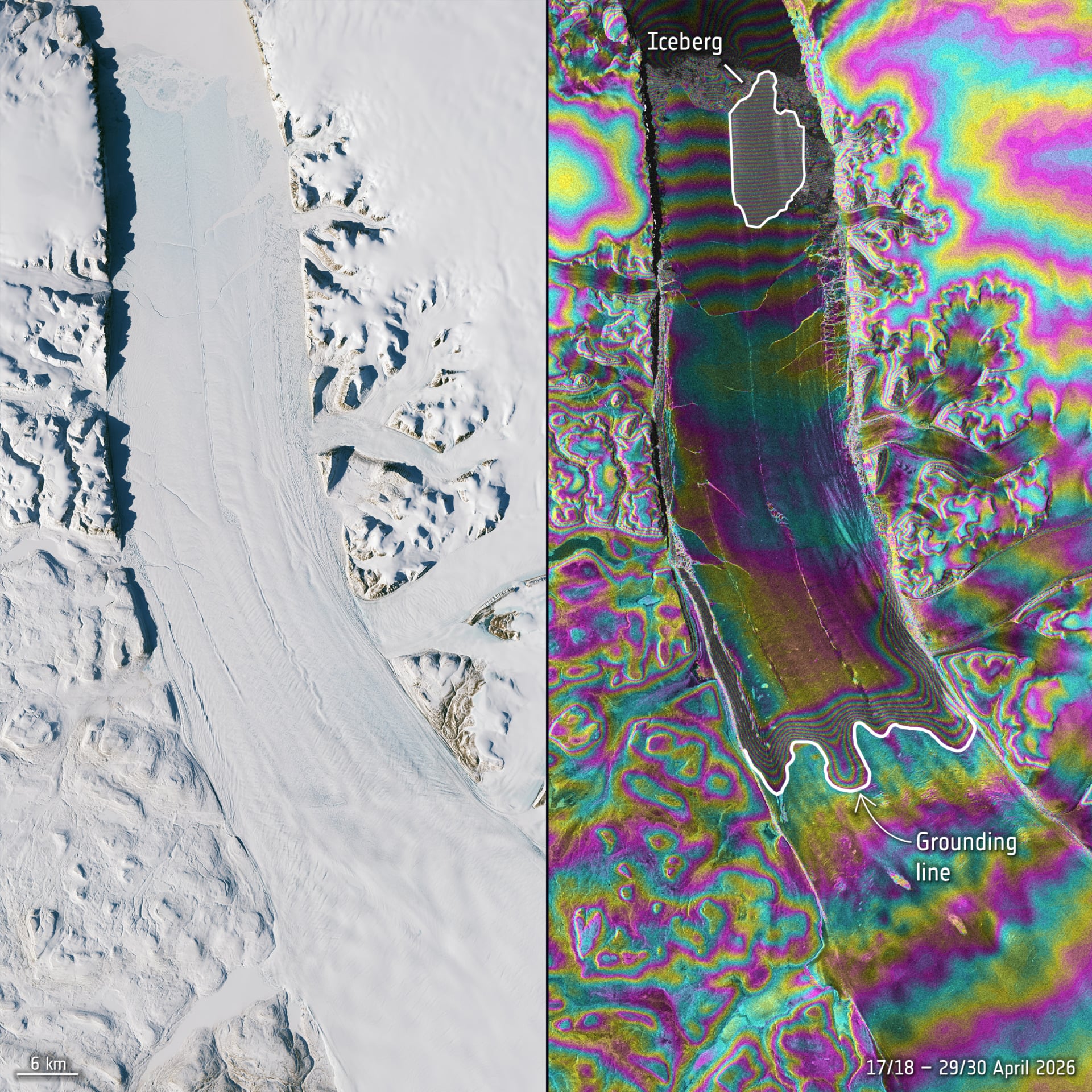
“The changes we observed on Petermann Glacier were occurring very rapidly in the lead up to the iceberg calving event, so it was incredibly exciting to monitor the crack propagation with interferometry in near-real time,” Molly Hammond, a PhD student from the University of Leeds, who processed the Sentinel-1 data, said in a statement.
The data allowed detailed measurements of fracture propagation across the ice shelf in the lead up to the iceberg calving event.
Ice loss
Several icebergs have broken off from Petermann Glacier in recent years, including a 97-square-mile (251-square-km) berg in 2010 and a 50-square-mile (130-square-km) berg in 2012. Scientists are anticipating at least two more calving events in the near future.
As existing rifts continue to propagate across the floating ice tongue, the future ice islands are projected to measure around 36.3 square miles (94 square km) and 32.4 square miles (84 square km).
Ice islands are a massive subclass of icebergs that usually feature a flat, plateau-like top with a wide surface area compared to their height. They break off from floating ice shelves or ice tongues in northwest Greenland and northern Ellesmere Island. Arctic ice islands are far less common than large icebergs and can float on for years before deteriorating.
Researchers will continue to monitor Petermann Glacier, as well as the newly formed ice island, using satellite imagery, aerial observations, and tracking data to keep an eye on its movement and fragmentation over time, according to ESA.
“Satellite missions such as Sentinel-1 provide the systematic, long-term observations needed to track these changes, helping scientists better understand the processes driving calving and the wider impacts on the polar environment, and ultimately the Earth system as a whole,” ESA’s Martin Wearing said in a statement.