Significant portions of Australia’s southeast coast are completely blanketed in thick smoke, as revealed by these upsetting new satellite images.
New images posted to NASA’s Earth Observatory show the grim effects of Australia’s historically bad wildfire season, which continues to worsen.
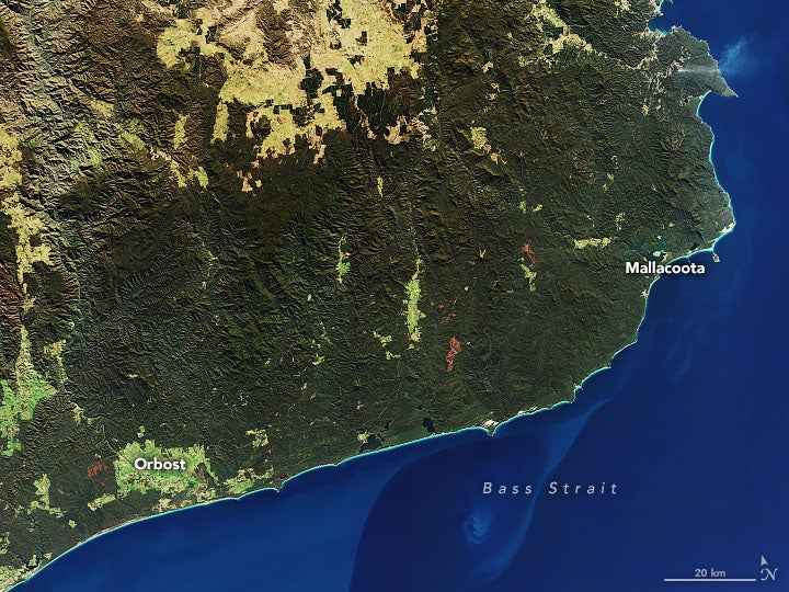
A natural-color photo (above) taken on July 24, 2019 by the Landsat 8 satellite provides a contextual view of a particularly hard-hit area state of Victoria, which hosts the resort town of Mallacoota and the historic tourist town of Orbost. A natural-color Landsat 8 image (below) taken on January 1, 2020, shows the region as it appeared earlier this week, as much of Australia’s southeast coast is currently covered in thick, noxious smoke.
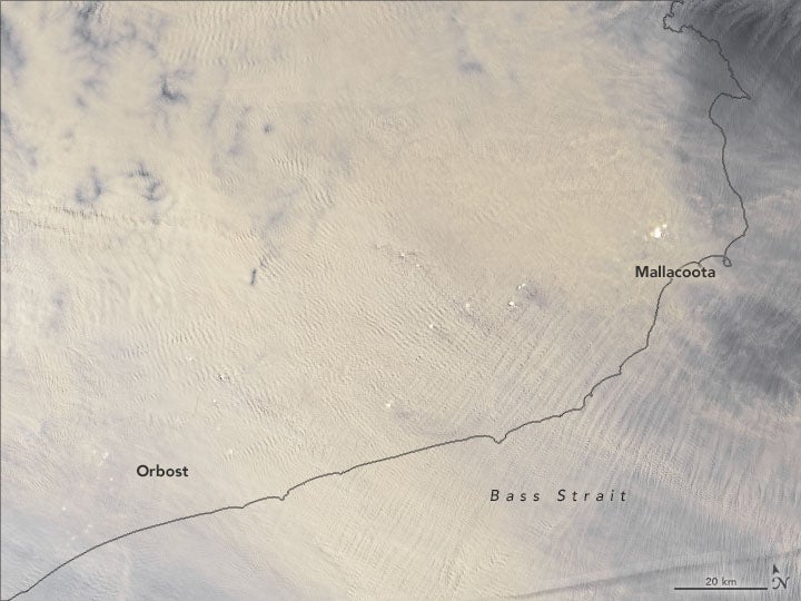
Looking at this smoke-covered image, it’s easy to see why residents are reporting dark, night-like conditions during the daytime.
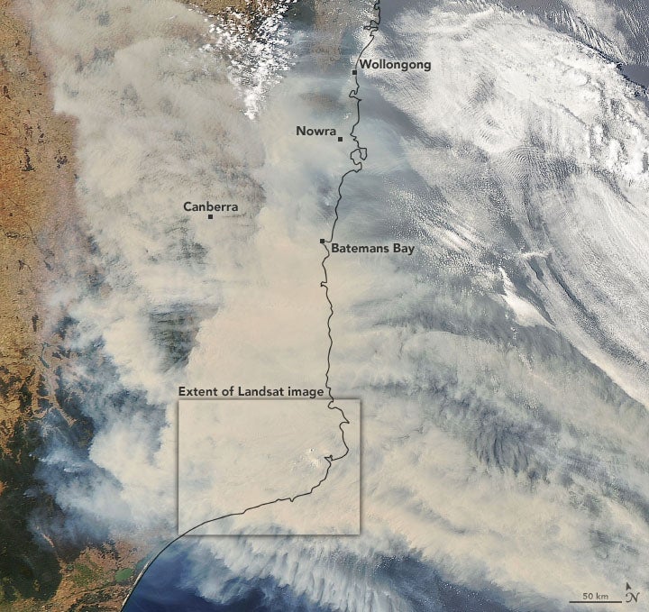
A second satellite photo (below), also taken on January 1, 2020, offers a wider view of the southeast coast, showing large swaths of tan-colored smoke drifting alongside white clouds. This photo, which stretches farther north through to Batemans Bay, Nowra, and Wollongong, was captured by the Moderate Resolution Imaging Spectroradiometer (MODIS) on NASA’s Aqua satellite.
The unprecedented wildfire situation in Australia appears to be going from bad to worse. Fires during the past several weeks have forced people from their homes. Australians have described many terrifying situations, including chaos in Mallacoota when the only route out of the area was blocked by fire, forcing residents, tourists, and firefighters to seek refuge on a beach. New South Wales has implemented a seven-day state of emergency that takes effect today, as conditions are expected to deteriorate even further. The state of emergency will likely include some forced evacuations.
https://gizmodo.com/australia-just-went-through-its-hottest-year-on-record-1840773414
Australia is absolutely cooking right now, as the climate change-ravaged country continues to set temperature records. Sadly, Australians will need to brace themselves, as there’s still plenty of summer left.