NOAA and NASA’s lovechild-slash-weather satellite, GOES-16, has been serving up some of the best images of Earth since it launched in November 2016. The satellite, which can take high quality images of Earth every 15 minutes, will be enormously helpful to meteorologists trying to predict extreme weather, which many climate scientists fear will increasingly become status quo.
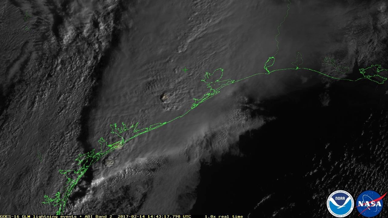
Now, GOES-16 is releasing the first images from its Geostationary Lightning Mapper (GLM). The GLM continually scans for lightning flashes in the Western Hemisphere, which will be enormously helpful for weather analysts of all kinds: Not only can the GLM track lightning in heavy rainfall, it can help firefighters in notoriously arid regions, as well. By scanning regions that are prone to wildfires caused by lightening strikes, the GLM’s information allows professionals to mobilize a faster response and potentially save lives.
Additionally, the GLM will help airplane pilots and mariners by alerting them to dangerous conditions that might be too difficult to see with other satellites. Not too shabby!
Serious stuff aside, look at how fucking cool GLM is watching this storm in Southeast Texas.
Currently, GOES-16 is peering down at Earth in a geostationary orbit about 22,300 miles above us. We salute its hard work and look forward to all the cool lock screen pictures it will undoubtedly produce in the coming years.
[NASA]