According to Herodotus’ Histories, Battus of Thera (modern-day Santorini) colonized the inland city of Cyrene in 631 BCE, reportedly driven by prophetic revelations. In the following years, the Greek settlers built Apollonia, an artificial harbor for trade and military vessels—not realizing that their engineering achievement sat on top of an active fault network.
In a recently published study in Libyan Studies, researchers describe a reassessment of the geomorphological, oceanographic, and archaeological history of Apollonia, which served as a major harbor for Cyrene. According to the study, the port reflects ancient architects’ keen awareness of natural limitations and shows how they got past them by engineering an artificial harbor—a feat that required the removal of roughly 170,000 cubic meters of stone. The new work also investigates why Apollonia has sunk roughly 8 feet (2.4 meters) underwater in the past 2,500 years, pointing to earthquakes rather than the sea level changes one might expect.
The research team included oceanographer Nic Flemming and archaeologist Ahmad Emrage, of the U.K. National Oceanography Center and the University of Benghazi in Libya, respectively.
Carving a coastline
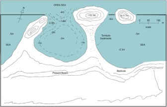
One key objective of the study was to define how much of Cyrene’s natural coastline ancient Greek engineers intentionally modified. According to the paper, previous surveys in the region turned up pottery from earlier periods.
This suggests that the region was “almost certainly” used by fishermen and merchants as a small trading hub. But the natural harbor was too small and dangerous for larger vessels, the team explained.
However, historical records indicate that Cyrene grew to be a rather wealthy city. By the 4th century BCE, Cyrene was exporting silphium—an unidentified wonder plant from the era—and had a fleet of ancient warships, which clearly shows it was “far more than a minor staging post for vessels,” according to the paper. Even setting aside the physical evidence, the historical context strongly suggests that Apollonia’s natural features went through major renovations.
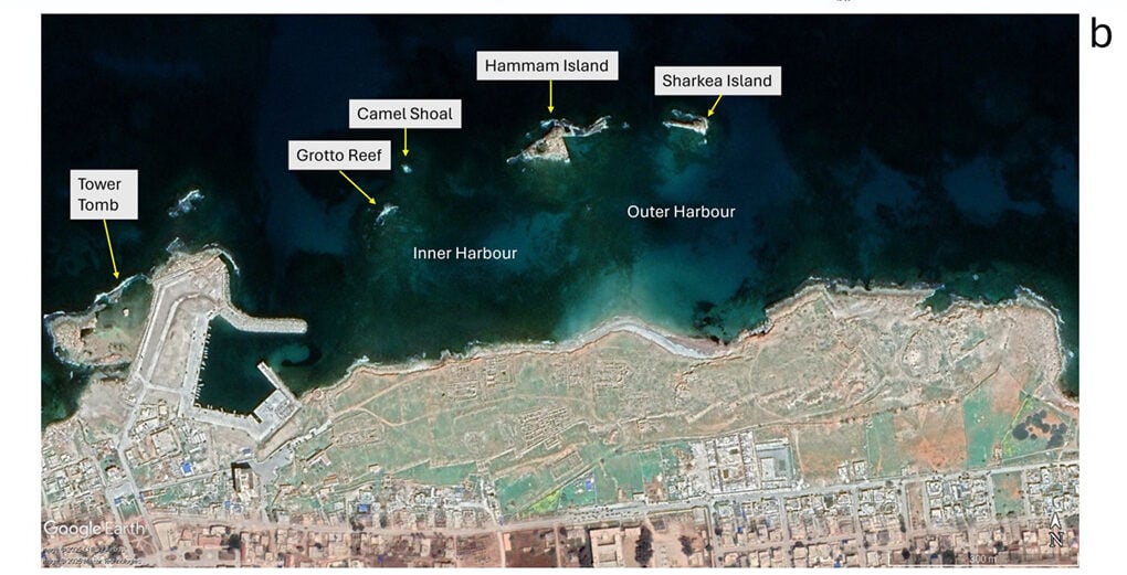
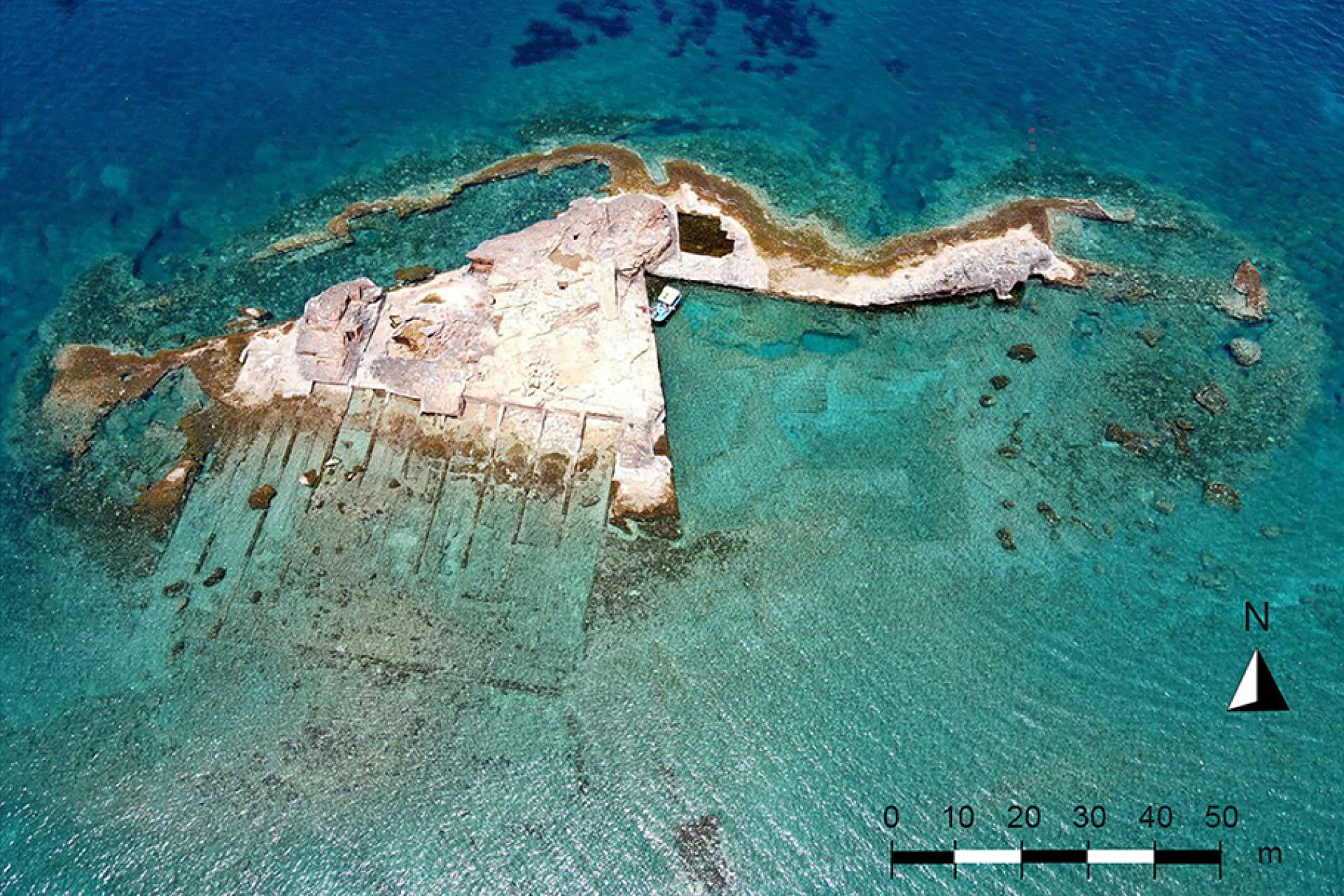
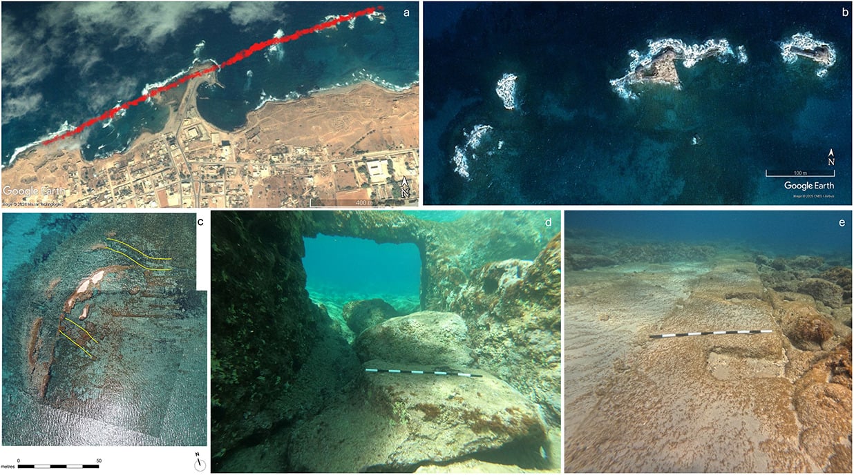
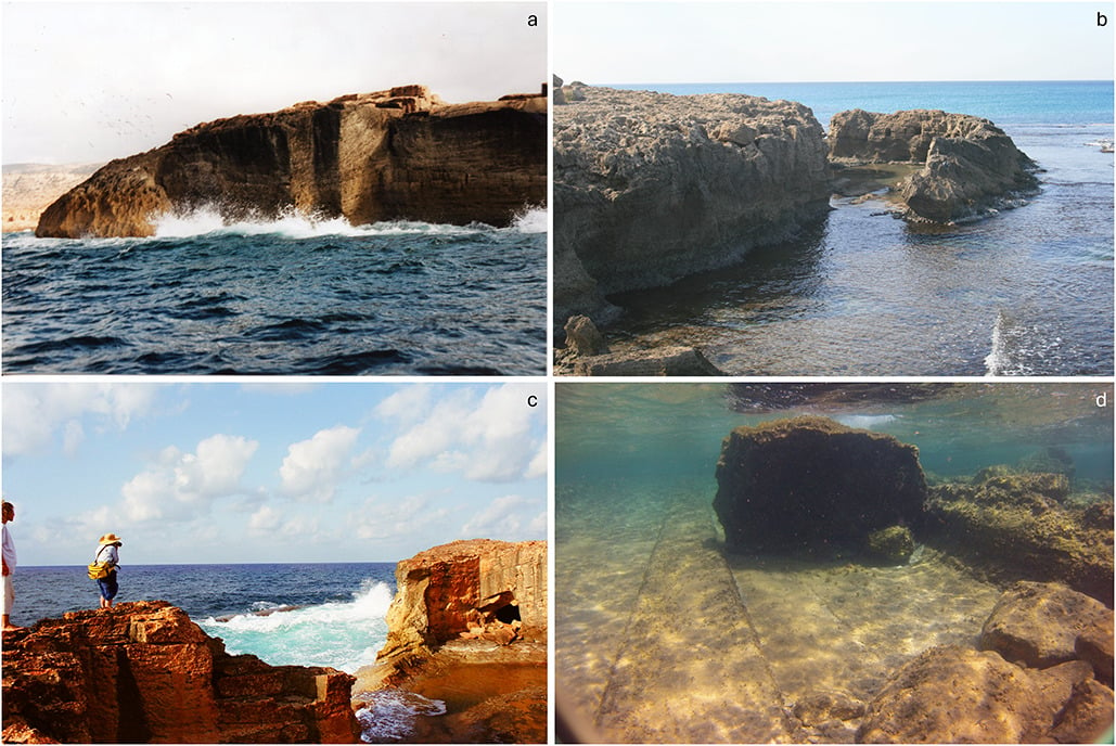
As for how they went about these upgrades, Greek engineers likely built a rubble breakwater during their first century of occupation. In 1959, Flemming discovered an area of rubble and large cut blocks during an underwater survey that supports this idea. This is also consistent with Bronze Age tactics for protecting harbors from wave motions, according to the paper. There are also signs of vertical carving on the submerged stone walls of Grotto Reef and Hammam Island, which is likely where the engineers sourced rocks for their fortifications.
An unfortunate choice
But ancient Greeks probably weren’t privy to the fact that Cyrene lay on top of a network of braided faults. This network, driven by the convergence of the African and Eurasian tectonic plates, has consistently brought mild-to-serious earthquakes to the region. Some of the stronger earthquakes are detailed in historical literature and have caused “considerable damage” to Cyrene’s architecture, the researchers added.
However, they stressed that it’s unclear, if at all likely, that a particular earthquake triggered the sinking of Apollonia. Past geophysical surveys indicate that the region experienced a tectonic subsidence of around 12 feet (3.8 meters) between the eighth and ninth centuries CE. Incidentally, earlier episodes of uplift offset some of that drop, leaving a net displacement of roughly 8 feet (2.4 meters), which is consistent with the current underwater depth of artificial slipways on Hammam Island.
Before the port fades
The latest assessment makes “substantial progress” in understanding Apollonia’s history but also raises many more questions, the team wrote. For instance, it would be useful to uncover the precise chronology of how and when the rocks were carved out of the islands, as well as the timing and magnitude of significant tectonic events. Unfortunately, this may be a race against time, given the increased natural and anthropogenic damage experienced by the region in the past few decades.
“Apollonia offers one of the most important case studies for understanding how ancient communities shaped and managed challenging coastal environments,” the team concluded. “The ingenuity of its early harbor works, the scale of its Hellenistic engineering, and the exceptional preservation of its submerged remains make it a site of outstanding significance.”