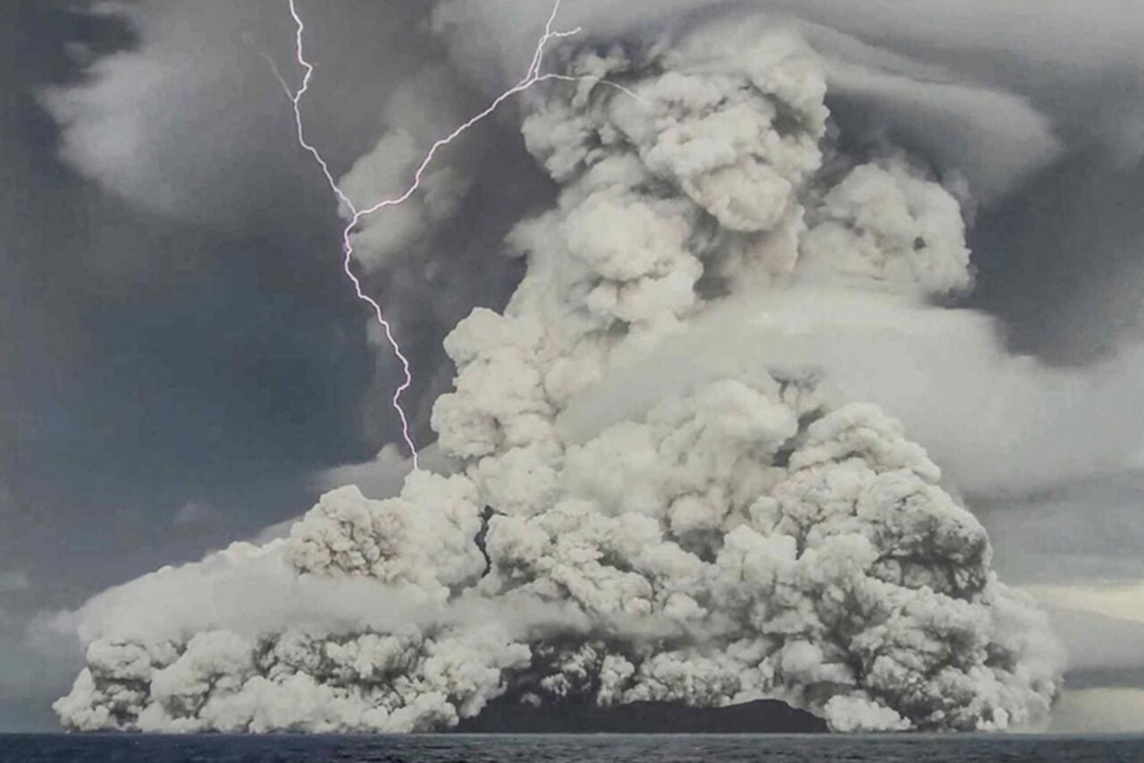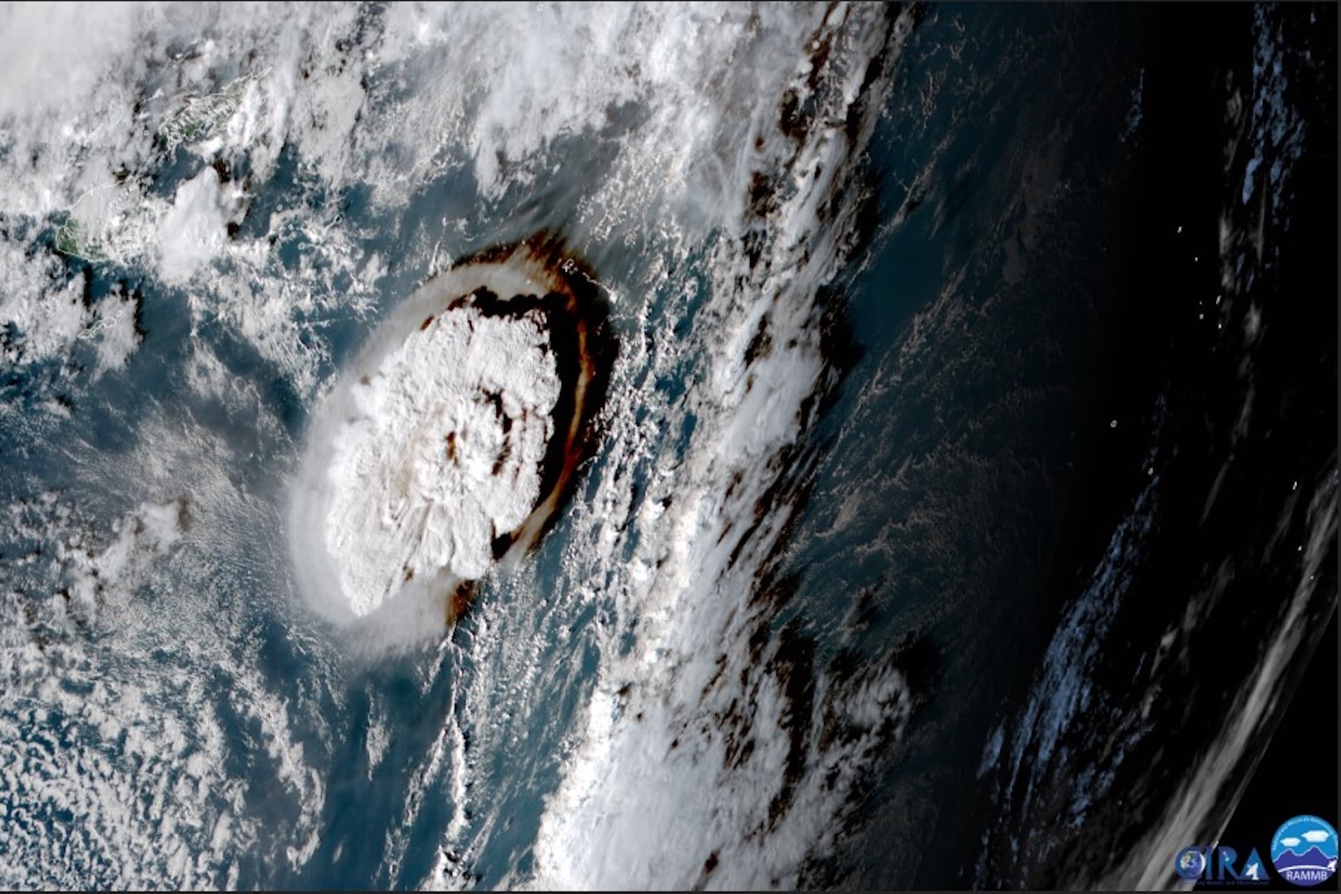
Every single house on Mango Island was swept away by the tsunami that radiated out when the submarine volcano Hunga-Tonga Hunga-Ha’apai exploded off the coast of Tonga in 2022. Only two buildings survived on nearby Fonoifua Island. Seven people were killed, and at least 19 more were injured—with many cries for help lost as the eruption’s undersea avalanche severed telecommunications cables. It was reportedly the largest and highest tsunami ever documented from an undersea volcanic blast.
The event was so powerful that scientists unofficially debated creating a new “ultra” category to describe it. But despite Tonga’s eruption being visible from space, very little data exists on submerged volcanoes like Hunga-Tonga Hunga-Ha’apai due to these geological formations’ deep-sea depths and the obvious challenges of doing science fathoms below sea level across far-flung patches of ocean. Nevertheless, a team led by marine geoscientist Marta Ribó at the Auckland University of Technology (AUT) in New Zealand has managed to amass an impressive body of evidence for what made Tonga’s 2022 blast so deadly.
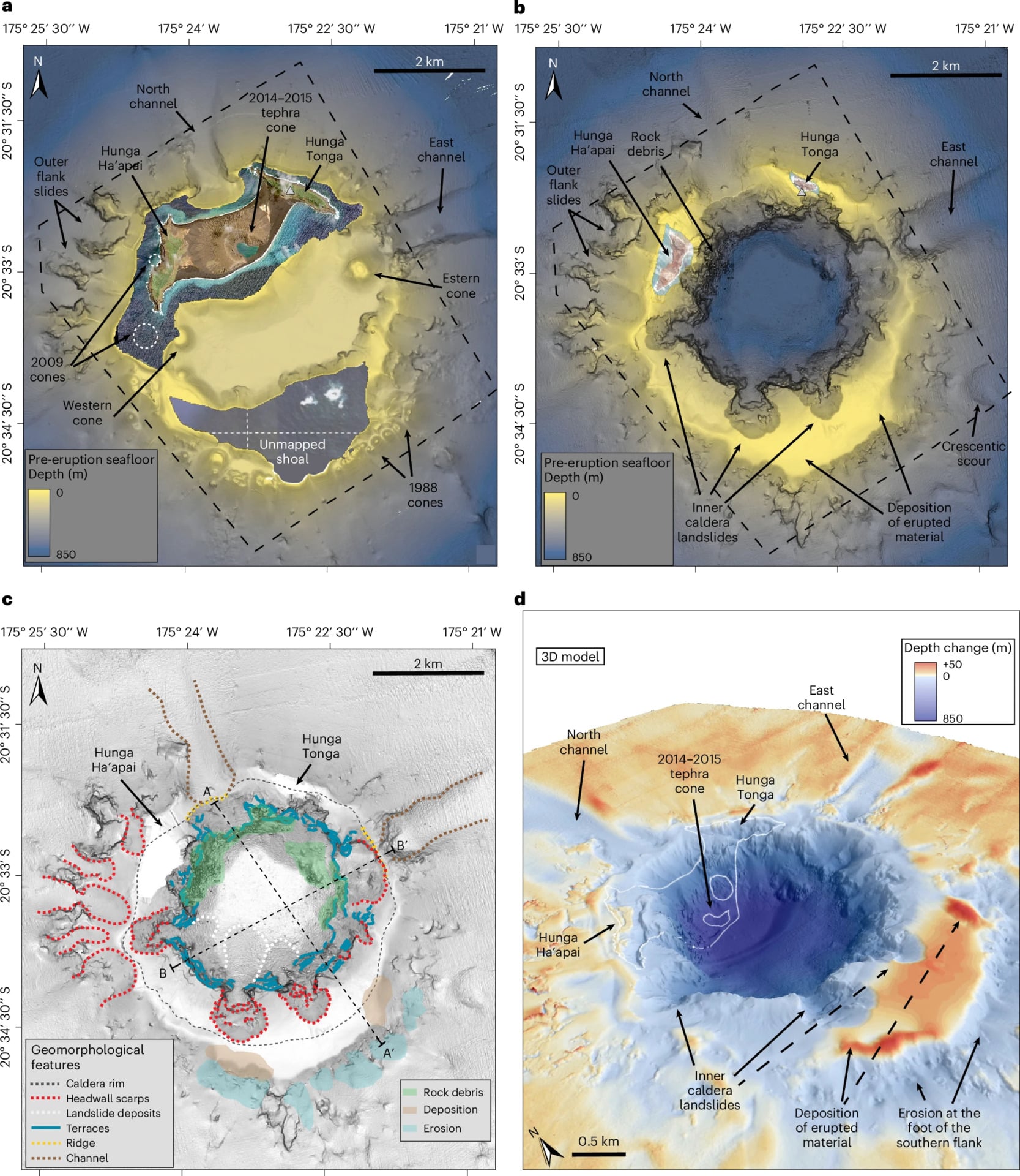
Using rare high-resolution sonar maps collected before and after the event, among other tools, Ribó and her team have determined that Tonga’s eruption created its unusually powerful tsunami by blasting out the geological formation above it into nearly one large, contiguous block. The heaving collapse of this mass back into the post-eruption depression, which geologists call a “caldera,” helped launch volumes of ocean water at “exceptional tsunami magnitude,” the researchers wrote, with waves as high as 131 feet (40 meters) as far away as 62 miles (100 kilometers) from the blast.
“Seafloor mapping before and after submarine [volcano] eruptions is very rare,” Ribó , the head of AUT’s earth and life sciences department, said in a statement. “Despite their recognised threat, most submarine caldera volcanoes remain unmapped.”
A bigger splash
Ribó and her collaborators paired these sonar maps, fortuitously taken before the eruptions in 2015 and 2016 and after in 2022, with water column observations to calculate the total volume displaced as the volcano’s caldera caved in.
In short, the collapse of Hunga-Tonga Hunga-Ha’apai moved volcanic material equivalent to the volume of 1,500 Great Pyramids or 89,000 modern aircraft carriers, according to the National Oceanography Centre (NOC) in the U.K., which collaborated with AUT and other institutions on this new study. The caldera sank about 490 feet (150 meters) to roughly 2,790 feet (850 meters) below sea level, moving an estimated 2.1 cubic miles (8.9 cubic km) of sea floor and another 1.6 cubic miles (6.85 cubic km) of material from the volcano itself.
Crucially, these mass-balance equations leave out the obvious role that the thermal expansion of ocean water into high-pressure steam added to the eruption’s power, as molten magma poured out around the edges of this volcano’s island-sized caldera block. Vulcanologists call these types of steam-enhanced blasts Surtseyan eruptions.
After the hunt
Isobel Yeo, a senior volcanologist at NOC who worked with Ribó on the new study, hopes that their work inspires future expeditions to continue mapping submerged volcanic structures worldwide in a search for particularly dangerous candidates. In addition to their study on the Tonga volcano’s collapse, published this September in the journal Nature Geoscience, their work also produced a research briefing in that same issue detailing the risks implied by their findings.
“Building repeat observations of these volcanoes is vital if we are to better understand the hazards they pose to coastal communities and critical seafloor infrastructure,” Yeo said in a statement.
Techniques like sub-bottom seismic profiling, for example, which uses sound waves to probe and characterize the rock layers hidden beneath the ocean floor, helped the team more accurately map the Tonga blast’s volcanic debris. Ribó believes that this kind of mapping work should be done for hundreds more undersea volcanoes to properly assess their risk of caldera collapse.
“There are at least 74 submarine volcanoes along the Tonga–Kermadec Arc, with 20 caldera complexes,” she noted. “Yet, despite the hazards they pose, they are not well-understood as they remain unexplored.”