If you’re already lucky to be able to afford a home in today’s housing market, then you’re likely going to want to make sure it’s not a pile of ashes by the end of your 30-year mortgage. Can’t believe you have to now factor in wildfires when considering where to settle down? Well, that’s just the way it is.
Monday, the New York nonprofit research group First Street Foundation released a free online tool mapping out the likelihood of wildfires by address in the mainland U.S., excluding Hawaii, Alaska, Puerto Rico and other territories. The site also tracks flooding, but while the U.S. government tracks flood risk down at the property level, it currently does not do the same for wildfires.
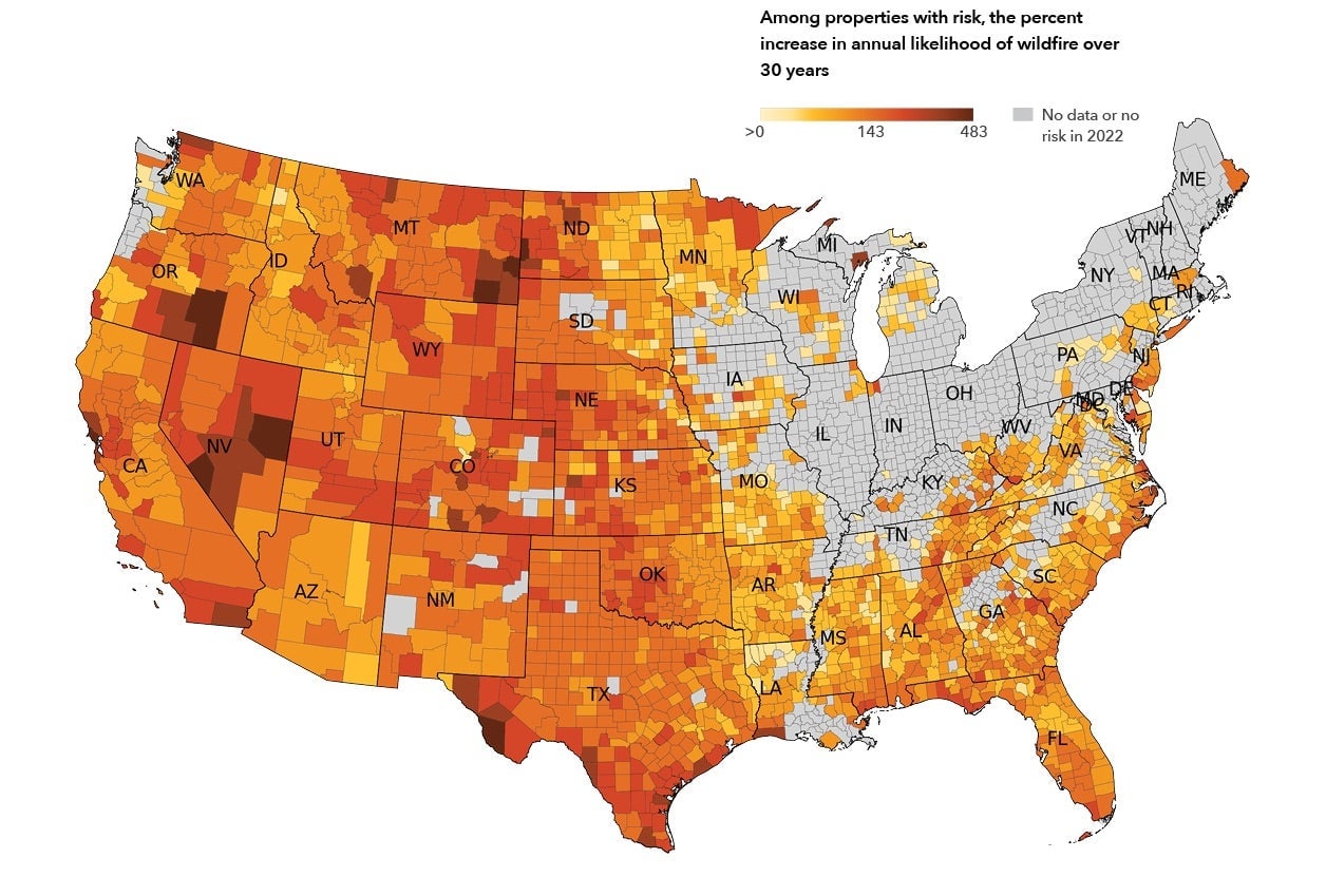
In a YouTube video and on its website, the nonprofit said how it compiled its Fire Factor data by taking in not just the past examples of wildfires at different locations, but considering which areas might be fuel for potential wildfires, alongside how combustible homes in the immediate area are. The model uses weather conditions from 2011 to 2021, then uses the standard RCP 4.5 carbon emissions scenario of approximately 2 degrees temperature rise to see how bad things could get over the next few decades.
In a release, First Street reported that over 30 million properties are at risk of being caught in wildfires. 20 million properties have a “moderate” risk of 6% likelihood of damage due to wildfire in 30 years, while another 6 million are at a “major” risk of more than 14%.
As first reported by The New York Times, a little less than half of all addresses in the southern U.S. states face at least some fire risk, according to First Street’s data. That number will rise to 56% over the next 30 years. Fire Factor data also shows that in Wyoming, 98% of all properties face some risk. In Montana, the percentage of properties of at least 1% risk is 93%. While over 806,000 properties are at risk in Big Sky Country and in 30 years—that number jumps to 836,000.
Risk accumulates over time, according to First Street’s data, meaning a home with less than 1% chance of being in a wildfire might have a total 14% chance over 30 years. Outside researchers who looked at First Street’s data told the Times that it’s best to think of the granular, address level data as estimates, not as guarantees.
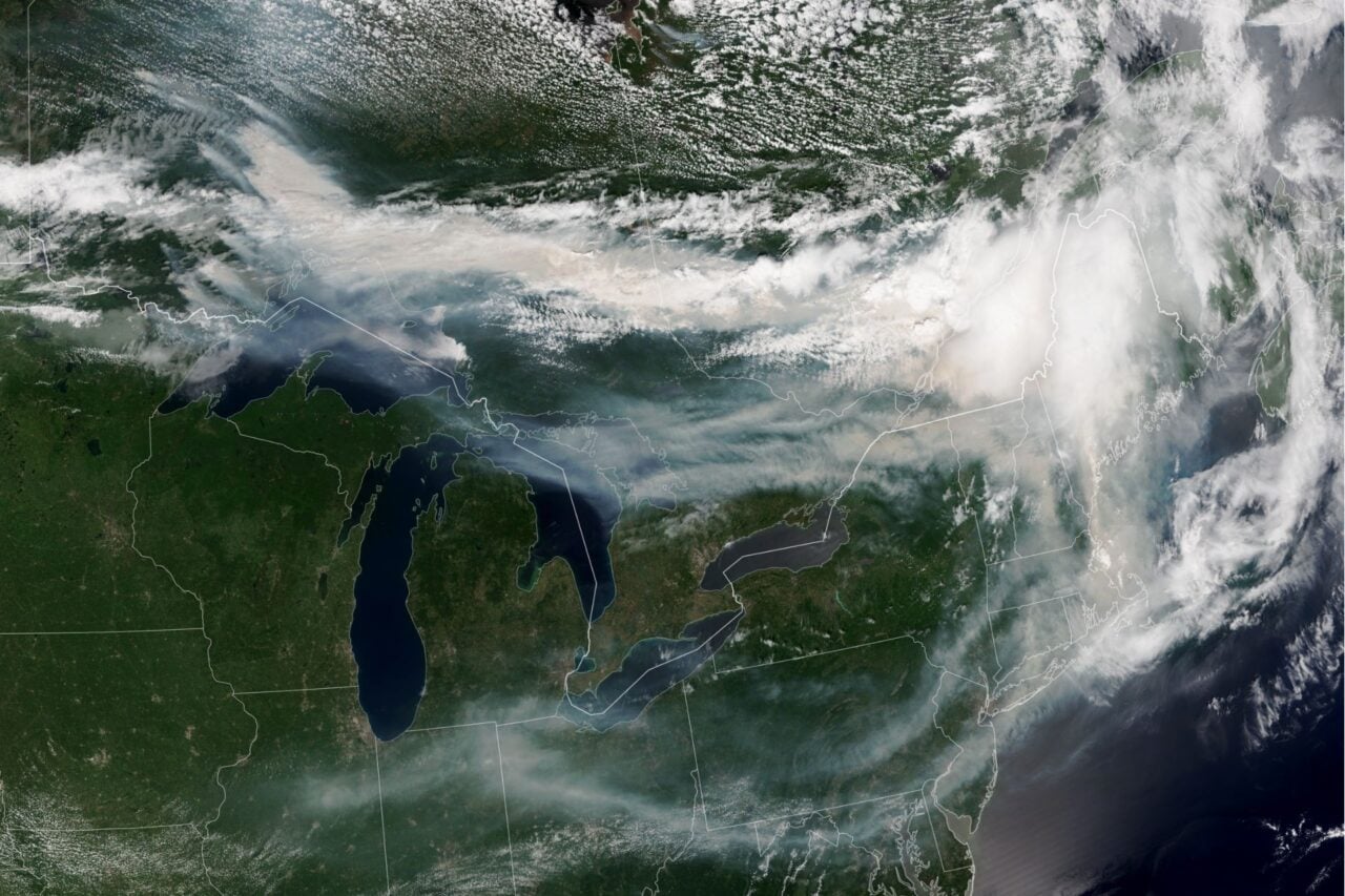
This year’s wildfire season (though due to climate change the growing number of fires over time could really be called a “wildfire year”) is already got off to a bad start. Among the dozen or so fires in the U.S. southwest and Texas includes the enormous 289,000-acre Calf Canyon/Hermit’s Peak megafire raging in New Mexico. Which likely won’t be contained until the end of July, according to the National Wildlife Coordinating Group. Some states that once felt safe from extreme fires are now thinking of mitigation. Oregon, a usually temperate state, will soon require workplaces to teach employees about how to react to wildfires.