Once again, the Atlantic hurricane season is forecast to be busier than average, the National Oceanic and Atmospheric Administration said Tuesday.
In a forecast issued for the 2022 hurricane season, NOAA projected that the number of storms this season would likely outstrip the 30-year average—the seventh year in a row that they’ve made such a prediction.
This year “is going to be similar to last year and given that you need only one bad storm to dramatically affect your life, if you fail to plan around this outlook, you’re planning to fail,” NOAA Administrator Rick Spinrad said in an interview with the AP. “You can take this outlook to the bank literally when it looks to protecting your property.”
This year’s hurricane season, which lasts from June 1 to November 30, will likely see a range of between 14 and 21 named storms, NOAA said. (NOAA’s names list for 2022 storms, by the way, contains bangers like Hermine, Gaston, Shary, and Virginie. Expectant parents, take note.) Named storms are tropical cyclones where wind speeds exceed 39 miles per hour (62.8 kilometers per hour). Between six and 10 of those named storms could develop into hurricanes (winds exceeding 74 mph [119 km/h]), three to six of which could be major hurricanes (winds exceeding 111 mph [178.6 km/h]). All in all, NOAA predicts that there’s a 65% chance this season will be more active than normal.
While the increasing number of intense storms seems like a slam-dunk climate signal, there are a lot of factors at play in determining what makes a strong hurricane season. For starters, there’s a La Niña effect in play this year, sending a polar jet stream toward the U.S. and making conditions in the southern part of the country dryer and warmer. This, in turn, can give hurricanes an ideal environment to grow and strengthen. Both 2020 and 2021 were La Niña years, and this natural phenomenon probably helped intensify the hurricanes those years. Scientists are also still not sure how climate change relates to the number of hurricanes increasing. NOAA has noted that improving technology is helping us catch and monitor more storms than we may have been able to in days before advanced satellites.
But that doesn’t mean climate change is totally unrelated to stronger storms—far from it. Storms need warm ocean surface temperatures to develop and strengthen, while warmer air can also hold more moisture, causing more and more intense rainfall. A study released earlier this year found that during the 2020 hurricane season, one of the most extreme on record, climate change caused 5% more total rainfall across all named storms, with rain coming down at a 10% faster rate. For that season’s hurricanes, the percentages were 8% and 11%, respectively. This study was the first to link the strength of an entire season of storms to climate change, signaling how research is still developing in this field.
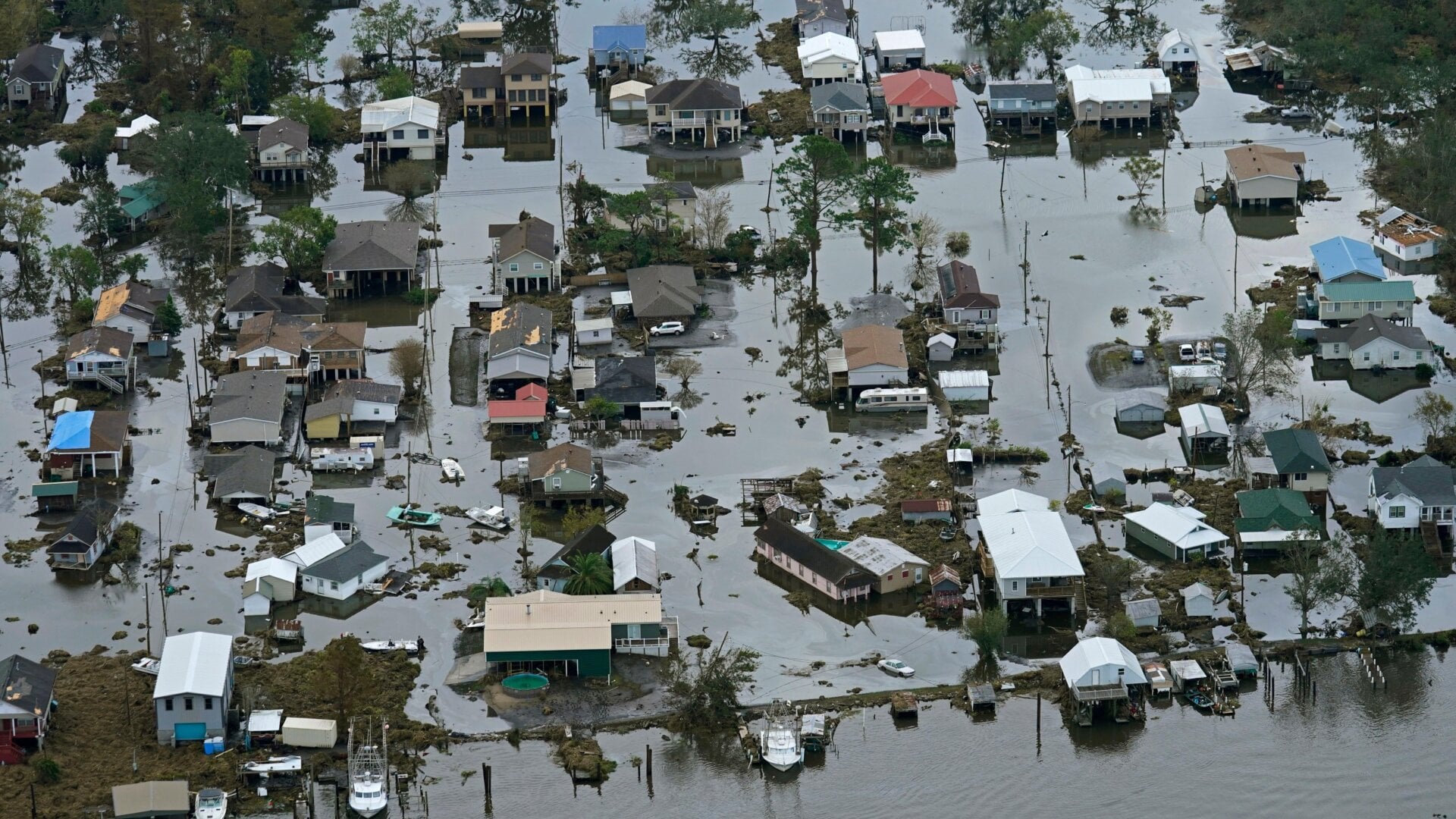
We also know that climate change is helping make those storms even more devastating when they make landfall, as sea level rise makes things far worse. Last year’s Hurricane Ida is a great example. When the storm made landfall in Louisiana as a Category 4 in August, the intense historic sea level rise on the Gulf Coast—which has seen sea levels increase by a whopping 50 feet (15.2 meters) thanks to a combination of climate change and coastal erosion—helped make the destruction even more widespread.