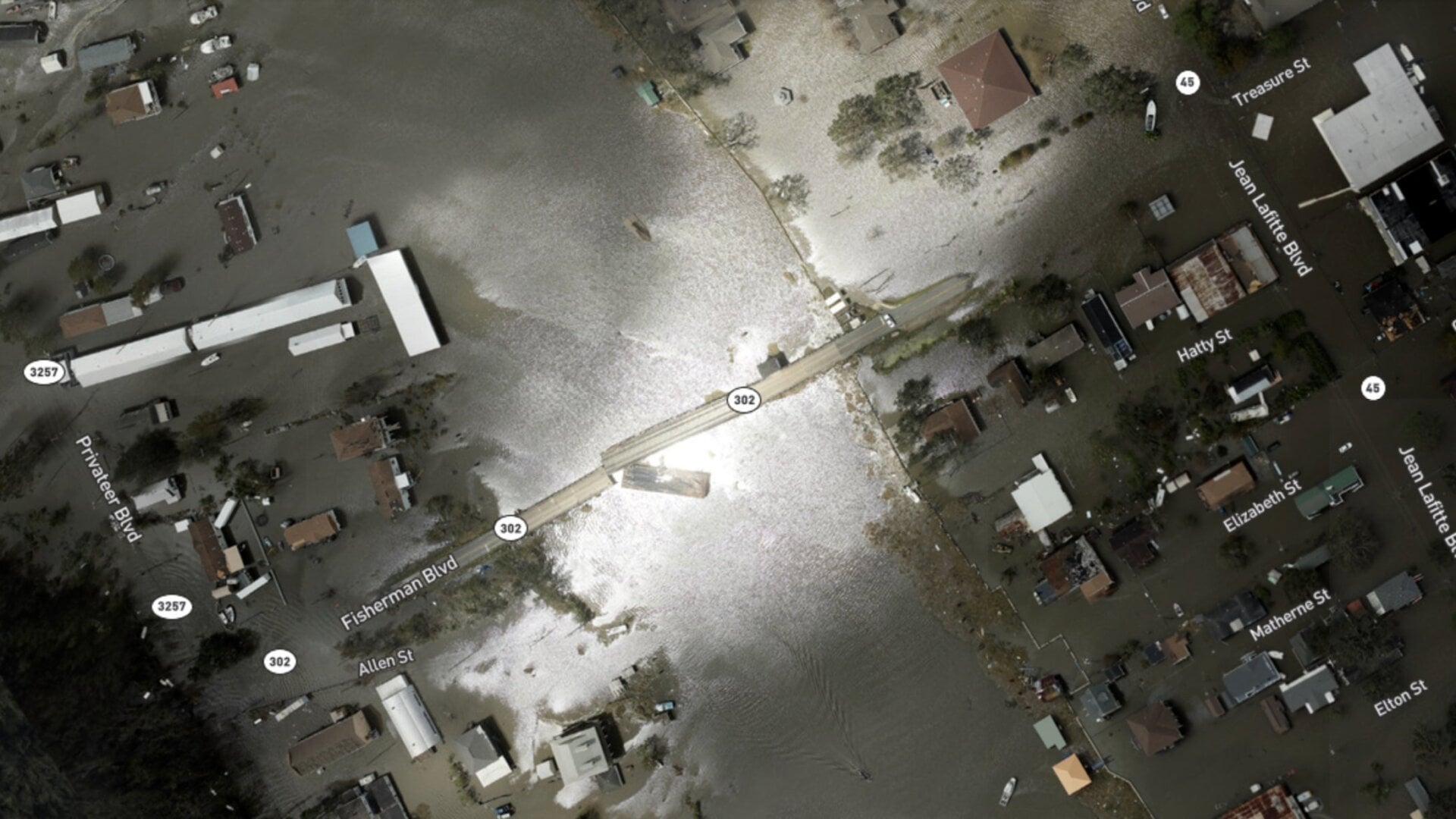
Hurricane Ida slammed into the Gulf Coast this weekend, but we’re still getting a handle on the damages from the storm. While New Orleans made it through the storm without much flooding (though the city is suffering from widespread power outages and sewage problems), other parishes around the city were hit hard.
In an effort to get a handle on the disaster and help target aid to communities in need—and spot chemical spills and other dangers—the National Oceanic and Atmospheric Administration has been collecting aerial imagery of the affected areas. Together with satellite imagery from before the storm, they show the shocking trail of destruction Ida left in Louisiana’s bayou and the communities that call it home.