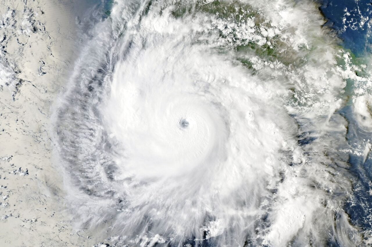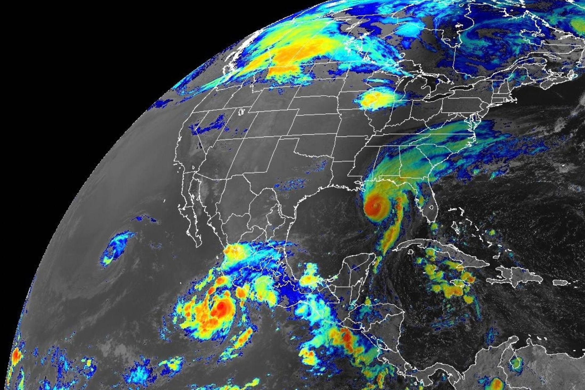
Millions in the U.S. and Mexico are bracing for damaging winds, heavy rain, storm surge, and flooding this weekend as three cyclones approach the shores of North America.
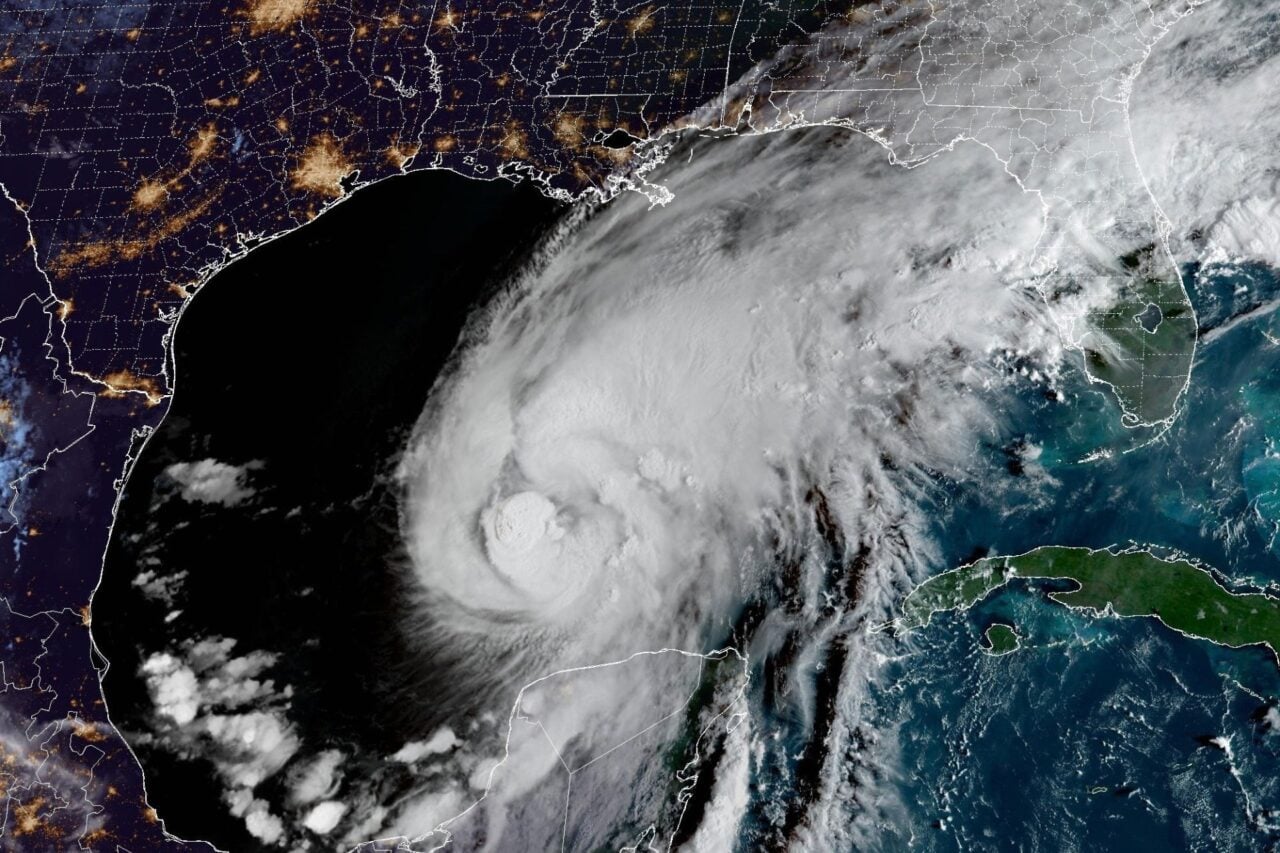
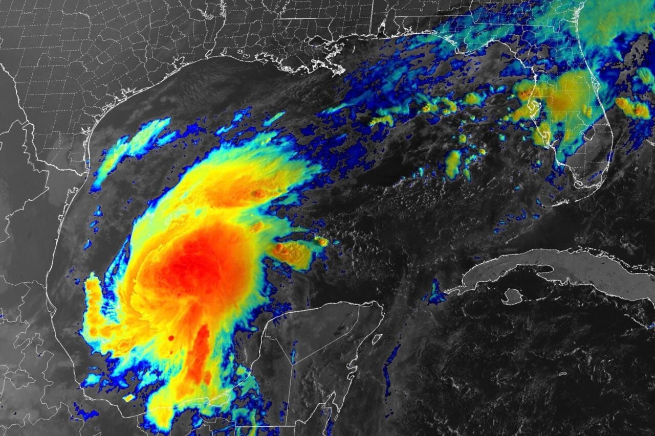
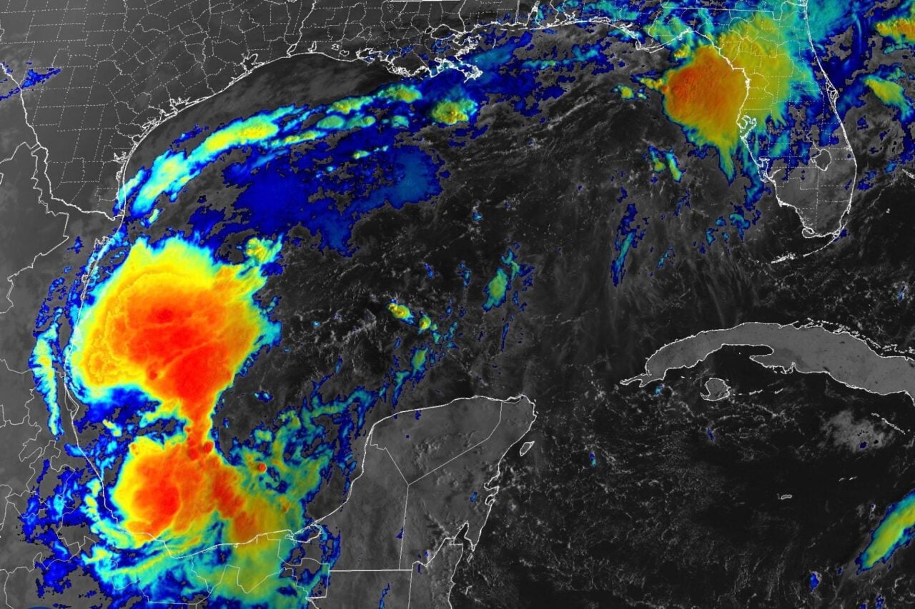
Hurricane Isaias, currently a major Category 3 hurricane churning in the Gulf of Mexico, will first make landfall somewhere between Alabama and the western Florida Panhandle. Forecasters at the National Hurricane Center believe the storm should weaken somewhat before coming ashore Friday night or early Saturday morning, but it will still pack a serious punch.
“Regardless of its exact wind speed at landfall, Isaias will be a dangerous hurricane with significant storm surge, damaging winds, and flooding rains,” the NHC wrote in an update issued at 5 a.m. ET today. “The wind field is also predicted to grow due to a trough interaction, and some of these impacts will extend well away from the center. After landfall, gusty winds are expected to reach well inland over portions of the southeastern United States.”
To the west, two Pacific cyclones are threatening Southern California and the west-central coast of Mexico. The NHC expects Tropical Storm Rachel to move ashore over the northern Baja California Peninsula late Saturday before continuing northeastward into the southwestern United States on Sunday, bringing strong, gusty winds, a risk of flash and urban flooding, and potentially life-threatening surf.
Southeast of Rachel, Category 1 Hurricane Simon is rapidly strengthening off Mexico’s central Pacific coast. The storm should approach shore as a major hurricane on Saturday and track northwestward along the coastline, according to the NHC. Forecasters expect life-threatening winds, swells, and storm surge to hammer coastal communities while heavy rainfall impacts portions of southwestern Mexico through the weekend.
“This rainfall may produce life-threatening flooding and mudslides, especially in areas of steep terrain,” the NHC stated this morning.
Meteorologist Colin McCarthy called this cyclone triple-threat an “extraordinary setup.” While the Pacific has been churning out tropical storms and hurricanes all season, fueled by a record-breaking El Niño, Hurricane Isaias is the Atlantic’s first of 2026—also due, in large part, to El Niño.
A record-late first Atlantic hurricane
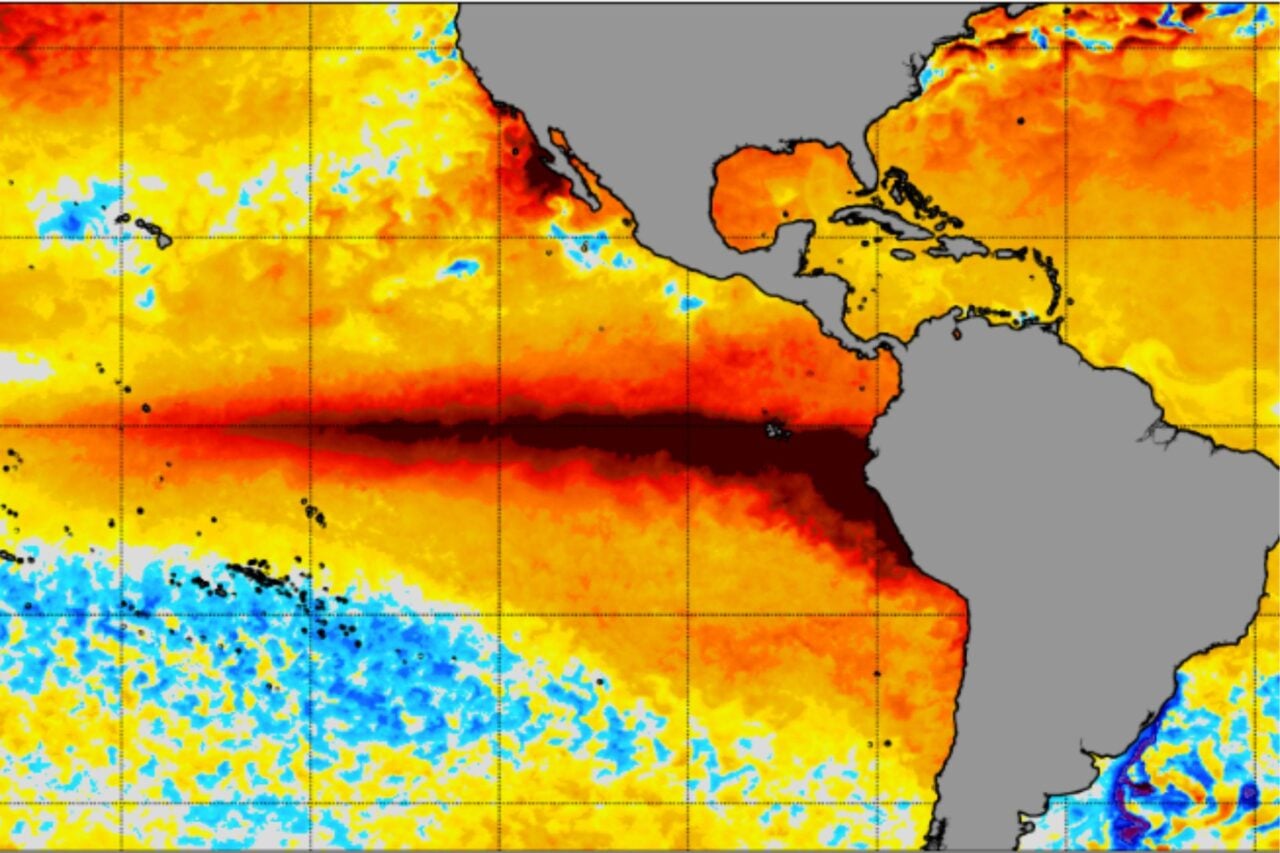
El Niño begins with a weakening of trade winds that causes warm water to shift from the western Pacific Ocean to the central and eastern tropical Pacific. Increased ocean temperatures off the coast of South America pump heat and moisture into the atmosphere, altering atmospheric convection, wind patterns, and global precipitation.
Warmer waters and decreased vertical wind shear make it easier for cyclones to form in the Pacific basin, while increased vertical wind shear in the Atlantic basin tears up storms before they can organize and strengthen. That helps explain why we’ve seen so many hurricanes in the Pacific but only one in the Atlantic during this very strong El Niño.
Isaias, which became a hurricane on Thursday, tied the record for the latest first hurricane of an Atlantic season. The basin’s exceptional quietude has been a major benefit to the United States, which receives the vast majority of its landfalling hurricanes from the Atlantic. Still, it only takes one storm to cause widespread damage, injuries, and fatalities, and Isaias will certainly be impactful.
The National Weather Service has issued storm-related advisories across a significant portion of the Southeast, particularly in Mississippi, Alabama, Florida, Georgia, and Tennessee. Federal forecasters are anticipating up to 9 feet (3 meters) of storm surge along the Gulf Coast from the Alabama/Florida line to Indian Pass, Florida. Storm surge and inundation will also pose a threat to coastal communities as far west as Morgan City, Louisiana, and as far east as Egmont Key, Florida.
Through the weekend, Isaias could dump 4 to 8 inches (10 to 20 centimeters) of rain across southern Alabama, the Florida Panhandle and Big Bend, and southwest Georgia, according to the NHC. Localized totals of up to 15 inches (38 cm) are also possible, particularly across the Florida Panhandle and Big Bend. Farther inland, Isaias could produce rainfall amounts of 2 to 5 inches (5 to 13 cm) and locally higher amounts up to 10 inches (25 cm), especially across the southern Appalachians and coastal Carolinas.
“Flash and urban flooding is likely across the region, with considerable impacts possible across much of southern Alabama and the Florida Panhandle into southwestern Georgia,” the NHC stated Friday. “River flooding is also expected, some of which could be significant.”
Isaias could even whip up some tornadoes, which would compound the damage from its hurricane-force winds. That risk will arrive later today and continue tonight in coastal areas of Alabama, the Florida Panhandle, and far southwest Georgia.
A rare West Coast tropical threat
Again, it’s unusual for a tropical cyclone to make landfall on the U.S. West Coast. Trade winds tend to steer Pacific storms away from the shoreline, and any that do approach usually weaken significantly as they encounter the cool waters of the California current.
Not even the exceptionally warm Pacific temperatures driven by this El Niño have allowed a cyclone to make landfall on the U.S. West Coast, but federal forecasters seem confident that Rachel will remain organized as it comes ashore, though that will be short-lived. The storm will likely become post-tropical over the southwestern U.S. by Sunday and dissipate shortly thereafter.
Still, Rachel’s winds and heavy rainfall will pose a significant threat to the Southwest this weekend. A risk of flash flooding stretches from Los Angeles, California, to Tucson, Arizona, and as far north as Pocatello, Idaho. Storm surge and swells will also threaten some coastal areas with inundation. The NWS has also issued wind advisories across a significant portion of Nevada, southwestern Arizona, and the southeastern tip of California.
The full force of this weekend’s wild weather setup remains to be seen, but federal forecasters are urging the millions of Americans in the paths of Rachel and Isaias to complete storm preparations today. As this ‘super’ El Niño continues to strengthen, there will certainly be more surprising storms in the months to come.