Want to vacation like a scientific explorer would? We’ve put together the ultimate travel guide for people who want to journey back to the earliest ages of the Earth. This guide to North American prehistory will take you to valleys full of fossils, mountains carved by ice ages, and petrified forests that are millions of years old.
Map by Stephanie Fox! Click to enlarge.
Dinosaur Provincial Park
Location: Alberta, Canada
Open to public? Yes, the park is very visitor-friendly all year. There are regular and “comfort” camping sites, as well as a visitor center, tours, hiking trails, and outdoor fossil displays.
Importance: The big attraction for the geology buff would be Dinosaur Provincial Park’s dinosaur fossil fields, which can be viewed on a group tour or on a self-guided walk. Some of the most important Cretaceous dinosaur finds come from these fields, which have provided over 300 dinosaur skeletons dating back to 75-77 mya and covering 60 different species. Photo by Elena Elisseeva via Shutterstock
Meteor Crater
Location: Arizona
Open to public? Yes, the crater site includes 3 lookout points along the rim, along with a visitors’ center that provides guided tours and a theater that plays a movie about meteor collisions. Admission prices are here, and more visitor information in the Flagstaff visitors’ guide on page 18 of this brochure [PDF].
Importance: The Meteor Crater is advertised as the “Best Preserved Meteorite Impact Site on Earth.” About 50,000 years ago, a 130-foot-wide asteroid hit Earth at ten times the speed of a rifle bullet, creating this 4,100-foot-wide crater with a depth of 570 feet.
Grand Canyon
Location: Arizona
Open to public? Yes, the Grand Canyon is a popular camping and hiking destination with one rim open all year, and the other open during the summer. Here is some visitor information.
Importance: According to UNESCO, this is the most spectacular canyon on the planet, with a width ranging from 0.3 to 18.6 miles and a depth of 0.9 miles. In addition to attracting tourists, the strata that are visible in the Grand Canyon reveal 2 billion years of geological history. Plus, even more geological formations, such as buttes and mesas, are visible from the rim of the gorge. Photo by Glenn Young via Shutterstock.
Petrified Forest Park
Location: Arizona
Open to public? Yes, the park includes a visitor center and a museum, as well as driving paths with overlooks and walking trails that pass by petrified wood, details here.
Importance: According to UNESCO, the resources at the park date back to the Late Triassic period, which was 205-225 mya. In particular, those resources include petrified wood (much of it clustered into five “forests”) at different stratigraphic levels, as well as the fossils of 78 species of animal. There are even petroglyphs from early human inhabitants.
Burgess Shale Site
Location: British Columbia, Canada
Open to public? Yes, the Burgess Shale is in Yoho National Park in Canada, which is open to the public. While you’re not allowed to explore the fossil beds on your own, there are guided hikes around the site.
Importance: The fossils at the Burgess Shale site are old, diverse, and very well preserved, including the remains of soft as well as hard body parts. Here’s what the official website says:
The Burgess Shale fossils merit special interest for several reasons: Their age – from the Cambrian period, 505 million years ago, shortly after an astonishing burst of biodiversity occurred in the ancient oceans. Their exquisite preservation – amazingly fine details of the structure of the animals are seen in the fossils, which tell paleontologists much more about what the ancient animals looked like, and how they lived. The fossils reveal important clues to the nature of evolution – all of the major types of animals (phyla) known today are represented in the Burgess Shale, plus others that cannot be placed in our modern classification system.
Mono Lake
Location: California
Open to public? Yes, Mono Lake is in a California state natural reserve, and encourages hiking, boating, swimming, camping, and a visitor center with programs that include guided walks.
Importance: When the lake’s salty, alkaline water interacts with freshwater springs, “tufa towers” of calcium carbonate grow out of the water. But while the tufa is geologically interesting, the lake itself is a piece of geological history: it is one of the oldest inland seas in North America, dating back to the formation of the Sierra Nevada mountains (which began to form in the Triassic). About 12,000 years ago, the sea used to fill the entire basin in which Mono Lake now sits, but the water has since shrunk to only a few lakes spread through the Great Basin. Plus, in recent science history, astrobiologists found organisms that substitute arsenic for phosphorus living in the lake. Photo by Caitlin Mirra via Shutterstock
Rancho La Brea
Location: California
Open to public? Yes, the tar pits seem to be pretty accessible. The specimens that have been recovered can be viewed at the adjacent Page Museum, which is open daily, except for holidays. In addition to checking out the pits, guests can look at scientists at work in a “fishbowl” lab and check out recovered specimens (and reproductions and restorations).
Importance: Rancho La Brea contains “the largest and most diverse assemblage of extinct Ice Age plants and animals in the world,” according to the Natural History Museum of Los Angeles. They date from the Pleistocene, 40,000 to 8,000 ya. Thus far, over 3 million specimens have been recovered, which adds up to more than 660 different species of animals and plants, including 59 mammal species and 135 bird species. The University of California Museum of Paleontology has more information on these specimens and what they reveal about Ice Age L.A. (Photo by Andy Castro.)
Raton Basin
Location: Colorado and New Mexico
Open to public? Yes; one of the trails in Trinidad Lake State Park, called the Long Canyon’s trail, passes by the exposed Cretaceous-Tertiary boundary (also called the K-T boundary). It’s open to hikers and bikers, and is only 0.75 miles long. The U.S. Geological Survey suggests several other sights to see.
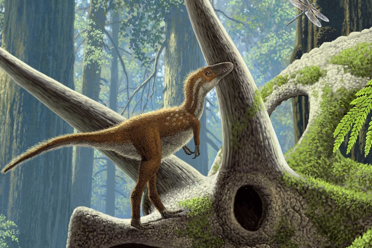
Importance: The K-T boundary, a thin band of rock that marks the boundary between the Cretaceous and Tertiary periods, and the mass extinction that occurred at that time, is exposed and visible in Raton Basin. This boundary also contains an anomalously high amount of iridium, which supports the hypothesis that the mass extinction was due to an asteroid impact, according to the U.S. Geological Survey. This band of iridium, called the “iridium anomaly,” is visible in sites all over the world, but is particularly striking here.
Raven Ridge
Location: Colorado and Utah, stretches through the border between the two states
Open to public? Yes, there is road access to Raven Ridge at the Mormon Gap
Importance: The exposed rock at Raven Ridge, turned up by tectonic activity, consists of layers deposited about 54-50 mya, which also contain fossils. This time period also includes the K-T boundary. The rocks of the ridge were originally in a lakebed before being tilted into ridges and valleys during the Laramide orogeny, when the Rocky Mountains were pushed up in western North America. Photo via NASA
Citronelle Formation
Location: Florida to Texas (continuous)
Open to public? It’s pretty big, so you can visit different parts of it, but one of the most accessible is in Citronelle, Alabama.
Importance: The Citronelle Formation developed from alluvial fans that were deposited on (formerly) coastal areas. As a result, it contains fossils of marine invertebrates dating from the Devonian to Mississippian, 320-480 million years ago.
Yellowstone National Park
Location: Idaho, Montana, Wyoming
Open to public? Yes, Yellowstone National Park encourages visitors to its geysers, hot springs, and other geothermal features. The park has a page on how to plan your visit and on what to do once you get there.
Importance: Yellowstone has half of all the globe’s geothermal features, including geysers and a mega-volcano bubbling menacingly beneath its surface. Anyone who wants to understand the molten rocks that churn beneath the Earth’s crust will have a lot to see here. Photo by naturediver via Shutterstock
Ice Age Flood Trail, Lawn Lake Alluvial Fan
Location: Idaho, Oregon, Washington
Open to public? Yes
Importance: Both of these landmarks are the results of melting glaciers causing floods. The Lawn Lake Alluvial Fan in Rocky Mountain National Park formed when a moraine dating back to the latest ice age gave way in the face of glacial floodwaters. During the last ice age, there were many floods across the American Northwest. The Ice Age Flood Trail is a route opened in 2009 near these sites.
Mazon Creek
Location: Illinois
Open to public? Yes, anyone can take a peek at the creek, and it’s popular with fossil hunters. In addition, fossils that have been excavated from the creek are on display in Chicago’s Field Museum and other locations.
Importance: Mazon Creek is one of the world’s best “Lagerstattens,” which translates to “fossil motherlode.” Fossils from this site are unique in the fact that their soft body parts (in addition to hard parts like skeletons and exoskeletons) have been preserved. The site is also notable for its diversity, with over 500 plant and 400 animal species discovered, which date back to the Carboniferous period around 300 million years ago.
Mammoth Cave National Park
Location: Kentucky
Open to the public? Yes, Mammoth Cave National Park encourages visitors to come hike, canoe, bike, camp, and tour the cave system.
Importance: At over 360 mapped miles, Mammoth Cave National Park is the longest cave system in the world. Other geological goodies include karst, terrain created when soluble rocks like limestone and dolomite dissolve. Mammoth Cave has been forming since 100 mya, and as a result of the karst it displays almost ever kind of cave feature, which makes it a great illustration of geological history. Scientists are working on a number of research projects on the site.
Sideling Hill
Location: Maryland, Pennsylvania, West Virginia
Open to public? Yes, a highway (Interstate 68) actually cuts through the hill near Hancock, Washington County, MD, providing a great cross-section of the strata. There is also apparently an exhibit on them at the Hancock Museum in Hancock, MD (scroll to the bottom for info on the Hancock-Sideling Hill Geological Museum.
Importance: The exposed strata of Sideling Hill are thick and of high quality. The syncline strata date from the early Carboniferous and Devonian periods, over 300 million years ago. (Photo by *nettie*)
Chicxulub crater
Location: Mexico, in the Yucatan Peninsula near Chicxulub
Open to public? Not exactly…we don’t think anyone would stop you from going to the impact site (the part of it that’s onshore anyway), but there doesn’t seem to be any museum or visitor center to tell tourists where to look and what they’re looking for. Other than cenotes, there’s not much to see. If you’d like to visit, there are some Google maps with the crater rim circled.
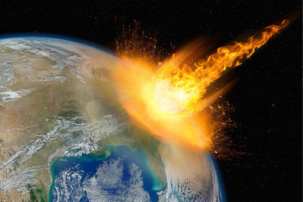
Importance: About 65 million years ago, an asteroid crashed into what is today the Yucatan Peninsula. It hit with a force millions of times stronger than a nuclear bomb, triggering seismic activity across the globe and spreading clouds of dust over the planet that led to years of winter and has been credited for driving the dinosaurs (and other species) to extinction. The idea that the asteroid was rich in iridium, and thus caused the iridium anomaly, has led many geoscientists to credit its impact with the creation of the K-T boundary.
Gros Morne National Park
Location: Newfoundland, Canada
Open to public? Yes, the park allows hiking and camping, and also has boat tours. More visitor information here.
Importance According to UNESCO:
Gros Morne National Park illustrates some of the world’s best examples of the process of plate tectonics. Within a relatively small area are classic, textbook examples of monumental earth-building and modifying forces that are unique in terms of their clarity, expression, and ease of access. The property presents the complete portrayal of the geological events that took place when the ancient continental margin of North America was modified by plate movement by emplacement of a large, relocated portion of oceanic crust and ocean floor sediments.
Rocks here date back almost 2 billion years. This is serious geophysical porn. (Photo by Michael A. Blanchard)
Huronian Supergroup
Location: Ontario, Quebec
Open to public? Yes, the Huronian Supergroup is accessible and can be surveyed by anyone who wants to check it out. To learn more about the geological history of specific sites in the area, the Wikipedia page on the Superior Craton is helpful.
Importance: The Huronian Supergroup is, according to the American Museum of Natural History:
A massive formation of rock laid down gradually between about 2.5 billion and 2.2 billion years ago, precisely the period when oxygen began to accumulate in the atmosphere. The Huronian Supergroup is 10 or 11 kilometers (six or seven miles) thick and extends well below ground. From atop a nearby outcrop, a viewer can survey the landscape for miles around. [In one segment,] Individual layers of ancient sediment form horizontal stripes on the rock. From a few steps back, the rock wall looks like a cross-section of a giant, stone encyclopedia.
Miguasha National Park
Location: Quebec
Open to public? Yes, Miguasha is a Quebec national park open to visitors. There’s hiking, picnicking, and a visitor museum.
Importance: Miguasha National Park, according to UNESCO, “is considered to be the world’s most outstanding illustration of the Devonian Period known as the ‘Age of Fishes’. Dating from 370 million years ago, the Upper Devonian Escuminac Formation represented here contains five of the six fossil fish groups associated with this period. Its significance stems from the discovery there of the highest number and best-preserved fossil specimens of the lobe-finned fishes that gave rise to the first four-legged, air-breathing terrestrial vertebrates – the tetrapods.” In addition to fish, there are other vertebrate, invertebrate, and plants fossils at the site. Thousands of these fossils have been discovered and shipped all around the globe.
Capitol Reef National Park
Location: Utah
Open to public? Yes, visitors can check out the visitor center, pick fruit, hike, drive along a scenic road, have a guided walk or program, and camp at Capitol Reef National Park. Here’s a detailed map.
Importance: The park contains the Waterpocket Fold, a 100-mile monocline, or “step-up” in strata. On the west side of the fold, the layers are 7000 feet higher than on the east. The fold formed 50-70 mya, but the rocks that are exposed date back from the Permian to the Cretaceous (270 to 80 million years ago). Essentially, the exposed sedimentary strata represent almost 200 million years of history, as well as including the edge of what was once a shallow inland sea.
Bryce Canyon National Park
Location: Utah
Open to public? Yes, visitors can hike, camp, and even attend geology talks or tours of the rim. Frommer’s has more on planning a visit to the park.
Importance: Bryce Canyon contains exposed rock formations that first started forming in the Cretaceous (144 mya until 63 mya). In addition, the Cretaceous Seaway covered the area for about 60 million years, which deposited sediment at the site. In addition, the canyon contains the rock formations called “hoodoos,” which are carved from rocks that were deposited about 66 to 40 million years ago. More information here. The “amphitheater” of the canyon alone reveals the long geologic history of sedimentation and erosion in a colorful sequence of rocks. Faulting, uplift and erosion give access to the discovery of plant and animal life in the region 130 to 40 million years ago. (Photo by Oleg Slyusarchuk)
Upheaval Dome
Location: Utah
Open to public? Yes, Upheaval Dome is a feature in Canyonlands National Park, which is definitely open to visitors.
Importance: Upheaval Dome is either a pinched-off salt dome or a crater from a meteorite impact, but current theories seem to lean towards the “crater” theory. However it formed, the dome eroded so that the rock layers visible within it are not visible anywhere nearby. According to geologists:
The core consists of the oldest rock formations at Upheaval Dome. The Organ Rock Shale and White Rim Sandstone of the Permian Cutler Group, and Triassic Moenkopi Formation were injected and pushed upward in a chaotic jumble. The Triassic Chinle Formation, Triassic-Jurassic Wingate Sandstone, and Jurassic Kayenta Formation and Navajo Sandstone are stacked, oldest to youngest, from the core to the rim.
If it was a salt dome, it must have formed over the course of 20 million years due to moderate pressure, rather than forming quickly under high pressure as it would have if it’s from a crater. In 2008, a paper claimed that quartz on the site had undergone high pressure, indicating that the crater theory is the winner. (Photo by Jesse Varner)
Checkerboard Mesa
Location: Utah
Open to public? Yes, visitors to Zion National Park are welcome to check out the Checkerboard Mesa. For more information on how to get to it, here is a guide.
Importance According to the National Parks service:
The name stems from the cliff s distinctive checkerboard pattern. The horizontal lines are caused by crossbedding, a remnant of ancient sand dunes. The vertical lines formed because of the contraction and expansion of the sandstone.
Adds Fodors: The distinctive waffle patterns on this huge, white mound of sandstone was created by eons of freeze/thaw cycles creating vertical fractures, along with the exposure of horizontal bedding planes by erosion.”
Buttermilk Creek
Location: Texas
Open to public? There have been archaeological digs here and at nearby sites, but they’re on private property.
Importance: Artifacts recovered from the Buttermilk Creek area (dubbed the “Buttermilk Creek complex”) indicate that humans settled America 2,000 years earlier than previously believed, putting them in this region 15,000 years ago. This indicates that humans may have migrated to the Americas via boat, rather than walking across the land bridge as previously believed. Given that early Americans came here every summer for seemingly thousands of years, it seems like a good place to have a BBQ, if you can figure out a way to do it without trespassing! Photo by Michael Waters.
Want more? If you’d like to take trips related to evolution, the Smithsonian has a travel guide to places all over the world related to evolutionary history.