Across the globe, people have heard about the damage Hurricane Maria caused in Puerto Rico and the Caribbean when it swept through the region a month ago, but few have actually witnessed it. Much of the island remains unreachable by land as bridges and roads remain blocked or inaccessible.
The only option left is to take to the air, and the National Weather Service is on it.
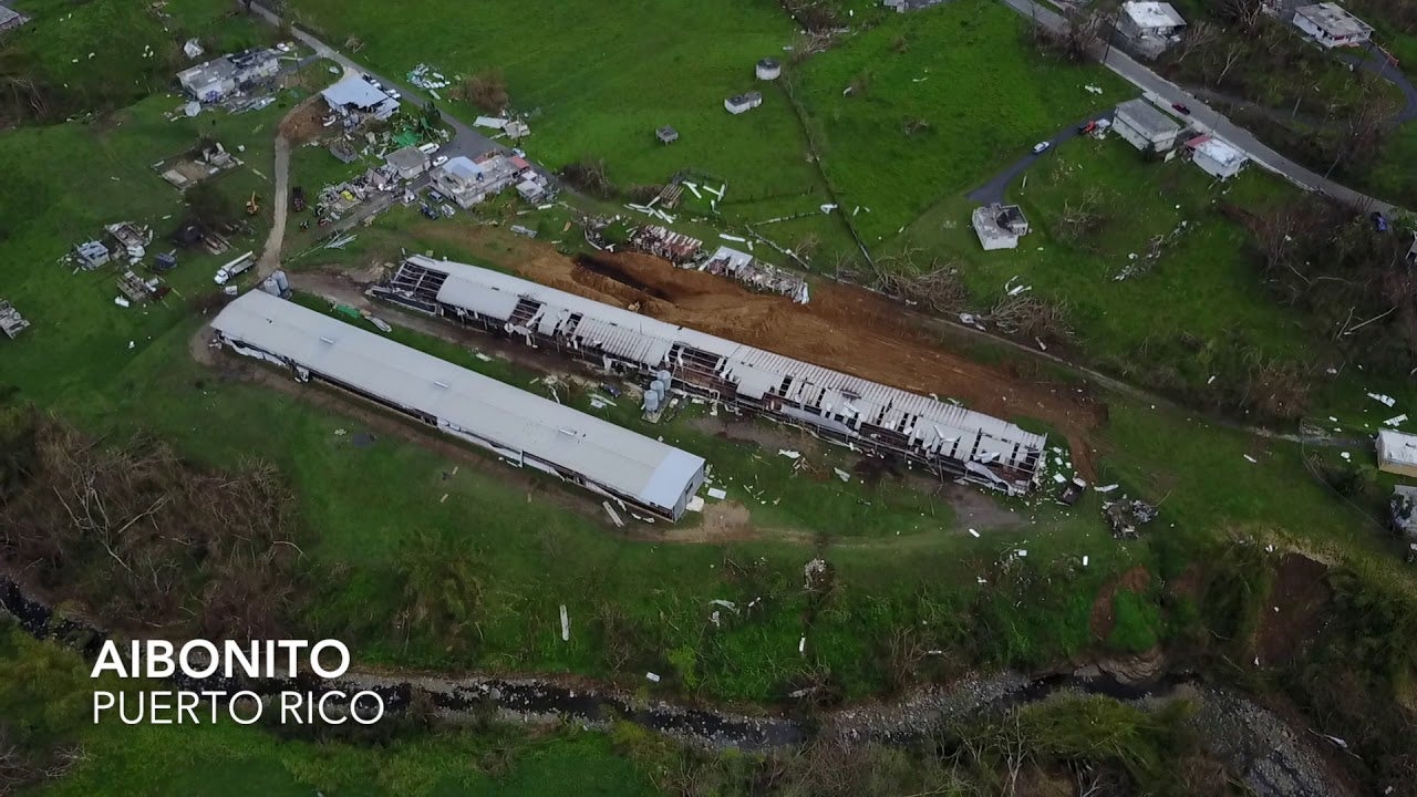
The service’s San Juan office released a video on Twitter Tuesday showing drone footage of what different villages and pueblitos in Puerto Rico look like. The lush green landscapes people might be familiar with are gone for the most part. What remains are overturned vehicles, dirt, debris, and houses with no roofs.
The video shows a car driving here or there, but the images are largely devoid of humans, and are eerily representative of the mass migration happening on the island.
As of Tuesday, schools have finally opened, but just 9 percent and only in the two major cities of San Juan and Mayagüez. The official death toll has risen to 51, but experts speculate the number could be as high as 450.
The video shows the devastation to some of the island’s renewable energy projects, such as a solar park in Humacao or wind turbines in Naguabo. The energy grid remains down for the most part: Only 25 percent have power.
More than a month has passed since Maria struck the island, but recovery back to normal feels nowhere in sight. This video, at least, paints that picture clearly.