U.S. coastlines saw record levels of high tide flooding last year, thanks to a combination of powerful storms and rising seas. This year is forecast to approach or even surpass that record.
The news comes in a report released Wednesday by the National Oceanic and Atmospheric Administration, which used data from 98 tidal gauges around the U.S. to make its prognosis for the 2017 meteorological year (which runs from May-April) and forecast for 2018. The findings point to an increasingly dire coastal flooding crisis.
The frequency of coastal high tide flooding—which the report defines as water levels “reaching or exceeding 0.54 meters [about 21 inches] above the long-term average daily highest tide”—has doubled in the past 30 years. And the trend is accelerating with the exclamation point coming in 2017, when there were six days of high tide flooding when averaging the number of days recorded at the 98 tide gauges.
“The underlying trend is quite clear,” William Sweet, an oceanographer at NOAA who co-authored the report, said on a call with reporters.
On its surface, six days of flooding might not sound like a lot. But most of those gauges have data going back to the early 20th century, and these types of floods were once rare. Greg Dusek, another NOAA scientist who worked on the report, used flooding in Charleston as an example.
The city was hit by the Lake Okeechobee Hurricane in 1921. The storm set a flood record that lasted until 1934, cresting 22 inches above the high tide flood mark. Fast forward to today and reaching that record that stood more than a decade is now a common occurrence, due largely to rising seas.
“We exceeded that value four times last year,” Dusek said. “We can see how flooding that used to occur during major storms or once in a decade now occurs with regularity 4-5 times per year.”
Some cities far exceeded the average of six flood days last year. Boston set an all-time high water mark in January due to the bomb cyclone. The city saw a total of 22 days with high tide floods in 2017, setting an all-time record.
Last hurricane season also took a toll. Hurricane Irma was almost forgotten sandwiched between Harvey and Maria, but the storm was no joke. It set flood records at 15 tide gauges on its path through the Atlantic and Caribbean.
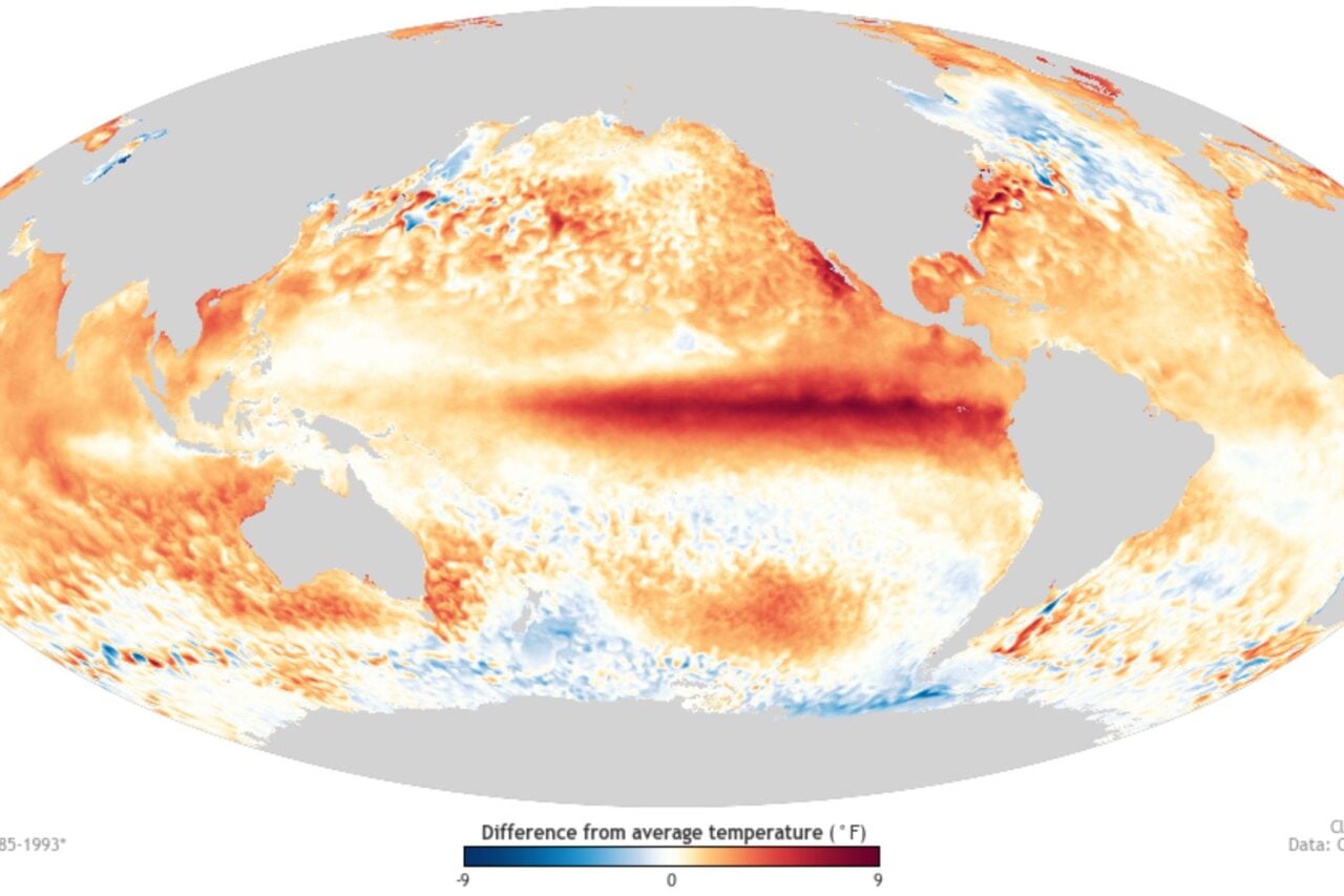
While this year’s hurricane season isn’t forecast to be as active as 2017, there are other factors that could make 2018 a nasty year for floods. Sweet noted that El Niño could emerge in the latter half of 2018. That warming of waters in the tropical Pacific can raise sea levels along the West Coast and change wind patterns in the Atlantic to create more swells and storm on the East Coast.
But it’s the backdrop of climate change that matters most. Sea levels are rising as the oceans receive more water from melting land ice and expand from rising temperatures. That means luck will run out for many coastal places lucky enough to stay dry today and when that happens, it will happen suddenly.
“Once impacts become noticeable, they’ll be come chronic rather quickly,” Sweet said.
And that’s why we need to get our act together now.


