Climate scientists and meteorologists are sounding the alarm as model projections show growing certainty of a “super” El Niño. Sea surface temperatures in the central equatorial Pacific could surge more than 5.4 degrees Fahrenheit (3 degrees Celsius) above average, challenging records held by the strongest El Niño events in history.
Such an event would significantly increase the global average temperature as an exceptionally warm Pacific Ocean releases massive amounts of heat into the atmosphere. A recent report from Carbon Brief shows that 2026 is already on track to become the second-warmest year on record, and 2027 could be the warmest on record if a super El Niño takes shape.
This would not only intensify extreme weather across various regions but could also lock Earth’s climate into a warmer regime.
Why so certain?
Experts have been talking about the chance of a super El Niño since March, but modeling certainty is growing as summer approaches. We’re still technically within the spring predictability barrier—a period of increased uncertainty for ENSO model projections—but the latest data from the European Centre for Medium-Range Weather Forecasts (ECMWF) is damning.
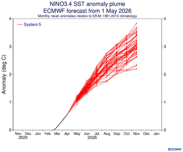
The graph above shows ECMWF model projections for sea surface temperature anomalies in the central equatorial Pacific, a key area scientists monitor for ENSO conditions. Each red line represents a different model’s forecast, charting how high the temperature will rise above average over time.
Every single model shows sea surface temperatures rising at least 3.6 degrees F (2 degrees C) above average by November, passing the threshold for a “very strong” El Niño. In the most extreme scenarios, temperature anomalies approach 7.2 degrees F (4 degrees C), which is well past the threshold for a super El Niño.
“Confidence is clearly shifting higher on potentially the biggest El Niño event since the 1870s,” wrote Paul Roundy, a professor of atmospheric science at the State University of New York at Albany, in a recent X post. El Niño records date back to around 1850.
How a super El Niño could influence extreme weather
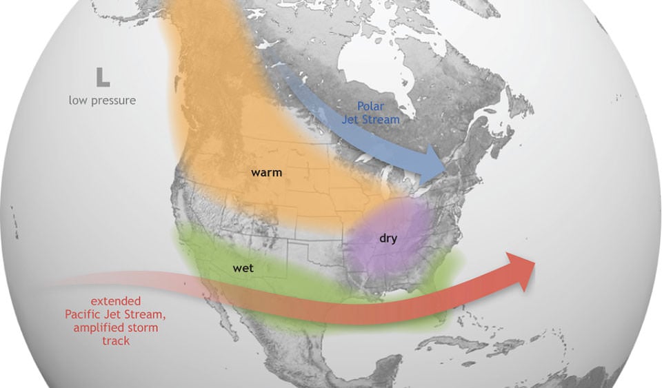
El Niño impacts vary region by region. Warmer ocean waters cause the Pacific jet stream to shift south of its ENSO-neutral position, bringing wetter weather to the southern U.S. and hot, dry weather to the north.
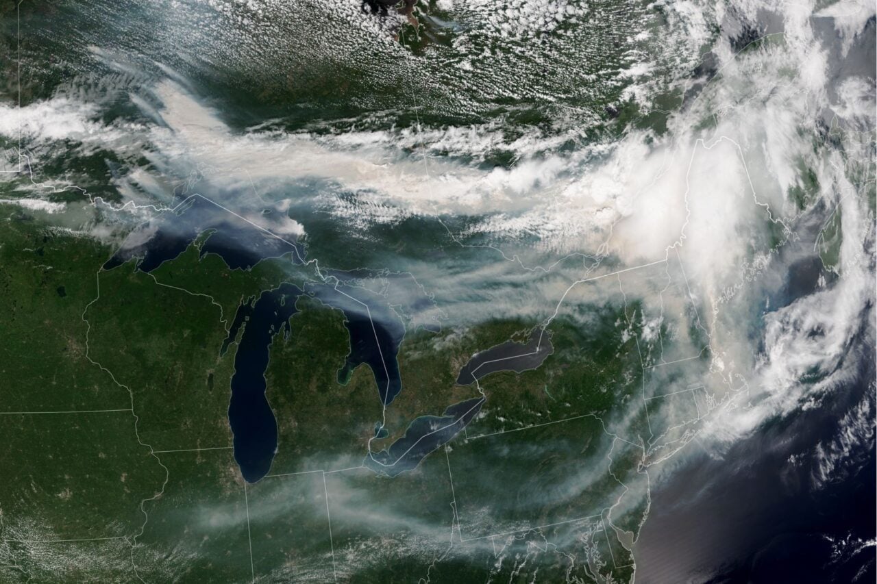
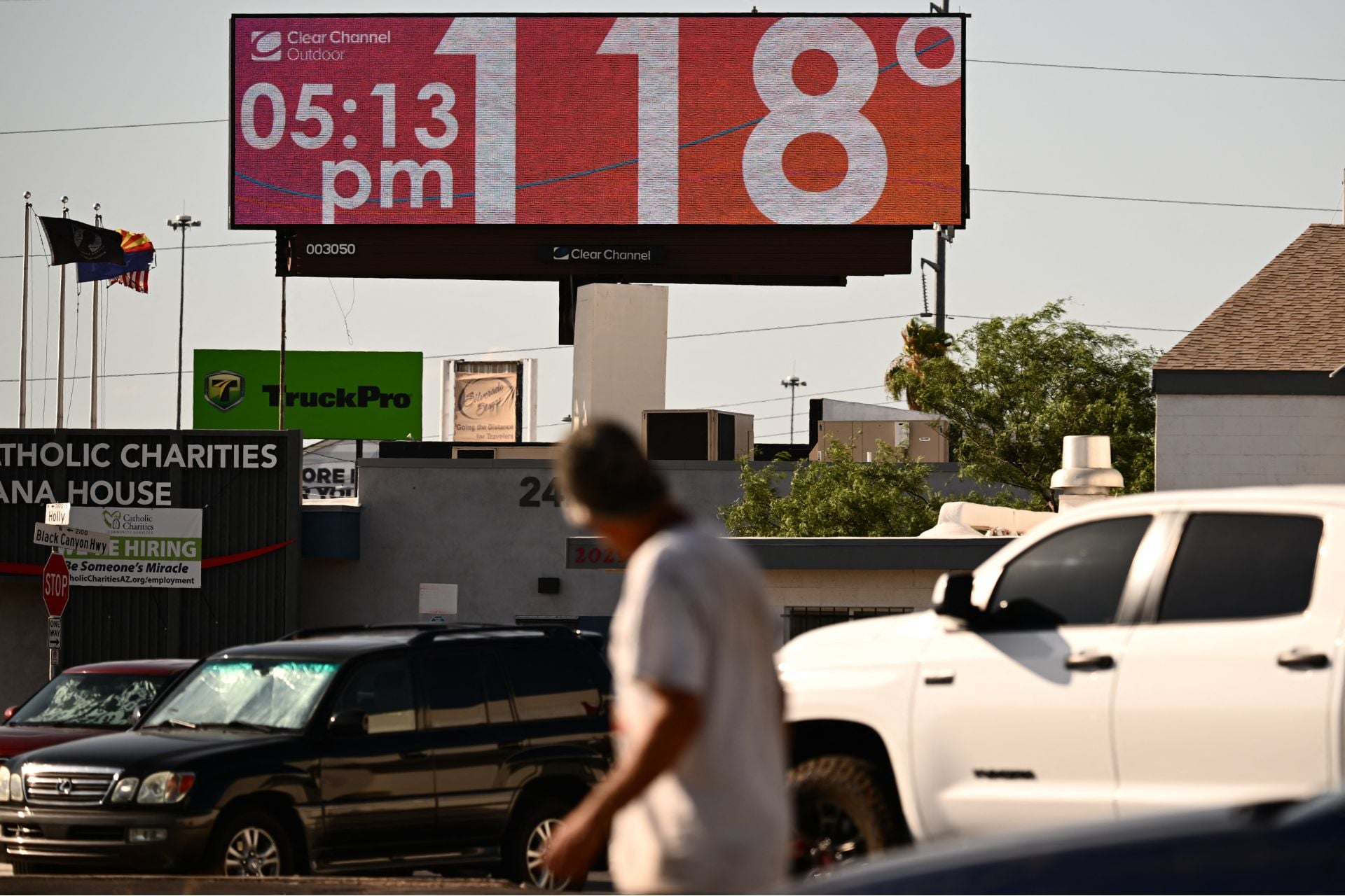
A super El Niño would have an amplified impact, significantly increasing the risk of drought and wildfire across the already parched Northwest and Great Plains. From coast to coast, southern states would likely see more severe thunderstorms and heavy downpours, raising the risk of flooding. And as average temperatures rise, heat waves will become more frequent and intense across much of the country.
Los Angeles and Southern California will need to prepare for extreme flooding and mudslides this winter 2026/27 as the Super El Niño intensifies across the Pacific Ocean.
Category 5 "atmospheric rivers" will bring enormous volumes (trillions of gallons) of warm precipitation. pic.twitter.com/Reg0kcjea7
— Ryan Maue (@RyanWeather) May 7, 2026
On the bright side, El Niño has historically led to a suppressed Atlantic hurricane season, so the Southeast could see fewer tropical cyclones.
On a global scale, a super El Niño could have a lasting impact on Earth’s climate. James Hansen, a climatologist at Columbia University, recently told Inside Climate News that even a moderately strong El Niño within the next 12 to 18 months could push the average global temperature 3 degrees F (1.7 degrees C) above the preindustrial level.
That would exceed the 2.7 degrees F (1.5 degrees C) warming threshold that the international community considers a turning point for catastrophic climate impacts, and Hansen doubts that the global temperature would meaningfully cool back down below that threshold after El Niño dissipates.
Exactly how this event will unfold remains to be seen. Experts will continue to track the development of this El Niño over the coming weeks, and we should have a better idea of its severity by the end of May. But even if the worst-case scenario doesn’t come to pass, this is shaping up to be a highly impactful event.