Chances of a “super” El Niño are rising as several climate models predict off-the-charts increases in Pacific sea surface temperatures by the fall. Meteorologists are growing increasingly concerned about what this could mean for global temperatures, extreme weather, and food security.
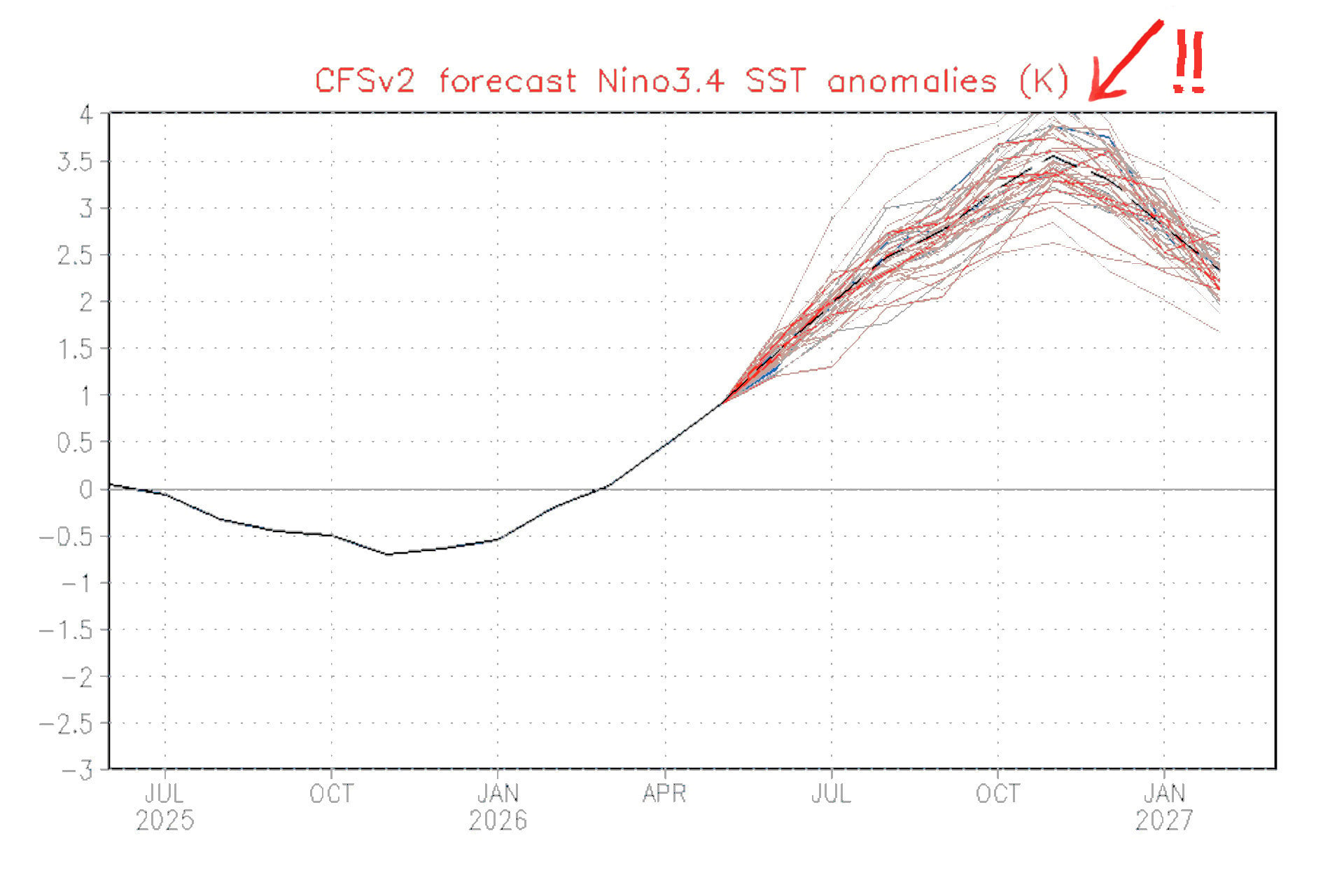
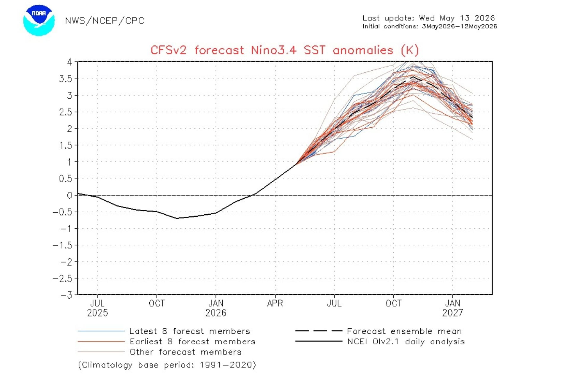
The latest projections from the National Oceanic and Atmospheric Administration, visualized in the chart below, all show sea surface temperatures rising at least 4.5 degrees Fahrenheit (2.5 degrees Celsius) above average by November. Some shoot over the top of the Y-axis, predicting temperature increases of more than 7.2 degrees F (4 degrees C) by that month. That’s well into super El Niño territory.
Looking at the graphic below and seeing the temperature values bleed over the top, I’m prompted to paraphrase from Jaws: Hey NOAA—you’re gonna need a bigger chart.
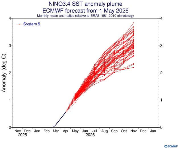
By comparison, the latest ensemble forecast from the European Centre for Medium-Range Weather Forecasts is less damning, but still concerning. This chart shows several models approaching a temperature increase of 7.2 degrees F (4 degrees C) by November, with the most extreme projection topping out at about 6.8 degrees F (3.8 degrees C). That’s still way above the threshold for a very strong El Niño.
Meteorologists are already comparing this developing event to the El Niño of 1877, when Pacific sea surface temperatures rose approximately 6.3 degrees F (3.5 degrees C) above average at their peak. It played a key role in fueling persistent, severe droughts in Asia, Brazil, and Africa, leading to widespread crop failure and a global famine that killed more than 50 million people. That was roughly 3.5% of the global population at the time.
Another global catastrophe?
As for whether this year’s El Niño could lead to a similar catastrophe, it’s highly unlikely. “The devastating losses associated with the super El Niño of 1877 to 1878 aren’t likely to repeat today because the social, political and economic factors that exacerbated the effects don’t currently exist,” meteorologist Ben Noll wrote for the Washington Post.
He notes, however, that a severe event could still significantly affect the global food system. According to the United Nations Office for Disaster Risk Reduction, the projected El Niño will likely lead to asymmetric impacts, with drought conditions reducing corn, rice, and wheat production across Asia and Australia while enhanced precipitation boosts soybean production in the Americas.
“As the world forges through geopolitical upheaval, a prospective ‘super’ El-Niño, albeit a non-standardized classification, threatens to further destabilize global supply chain,” the UNDRR states. “The looming El Niño will likely coincide with conflict-induced trade restrictions in the Middle East, which have already stranded maritime shipments, driven transpacific container rates 40 percent above pre-crisis levels, and restricted critical urea and phosphorus fertilizer exports.”
Researchers estimate that the last super El Niño, which occurred from 2015 to 2016, ultimately cost the global economy $3.9 trillion.
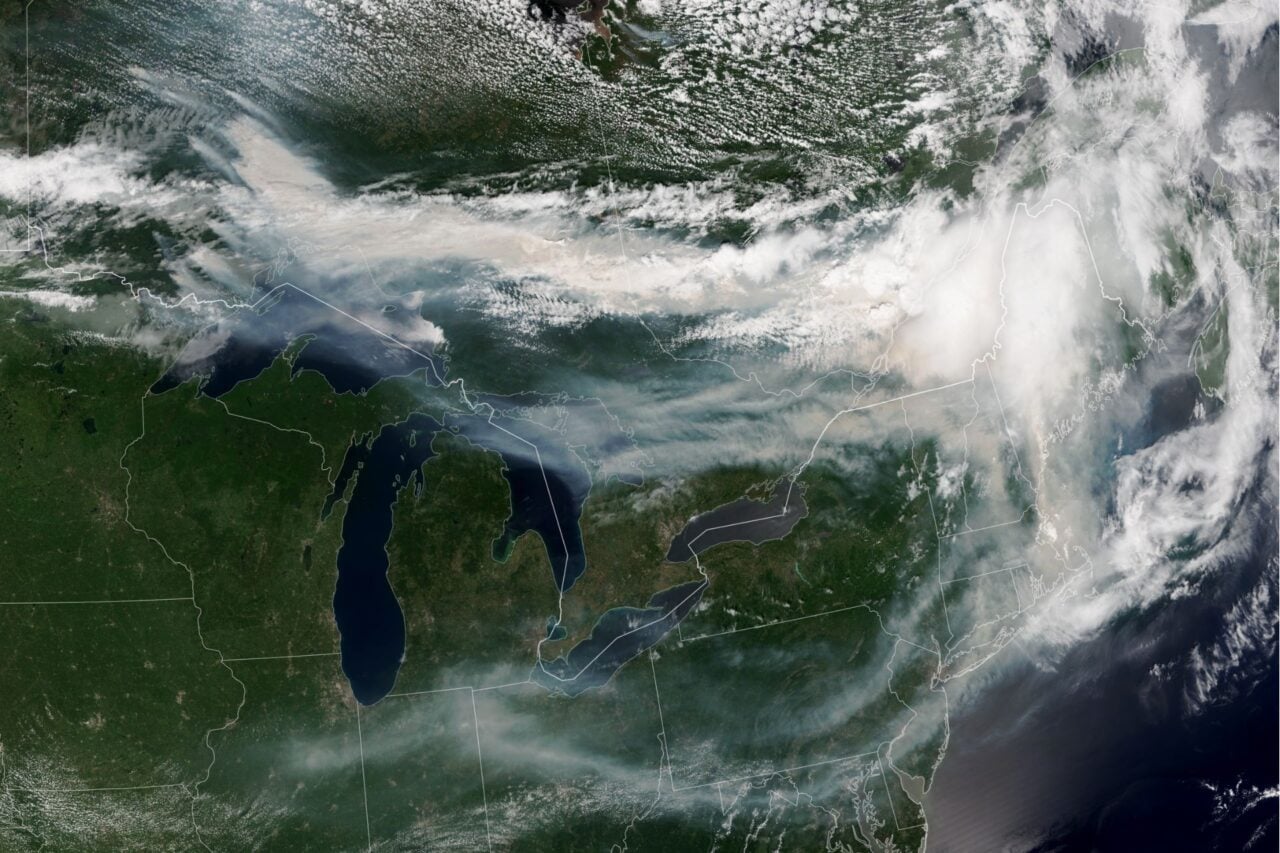
If this event turns out to be as severe as forecasts suggest, we could be looking at similar losses. A super El Niño could also push global temperatures to new heights, potentially making 2027 the warmest year on record. All that extra atmospheric heat will intensify extreme weather across the globe, exacerbating droughts, floods, tropical storms, wildfires, and other disasters.
The full intensity of this growing El Niño remains uncertain, for now. But as models increasingly point to a potentially historic event, world leaders should prepare for weather impacts and economic instability that may persist long after Pacific sea surface temperatures return to normal.