By analyzing satellite photos, geologists are able to measure the depth of the lakes that form on glaciers during the summer months. Fascinatingly, the process that produces these lakes is also responsible for their remarkable depth.
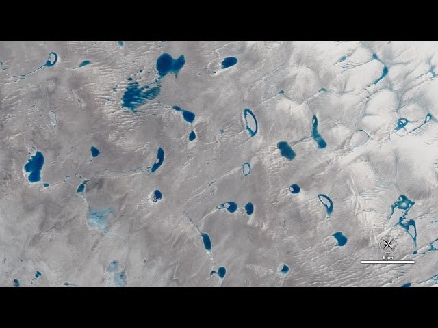
Satellite images of Greenland’s Jakobshavn Glacier reveal a network of lakes strewn across the top of its surface. These seasonal lakes expand in size because they’re darker than the ice around them, causing the melt water to absorb more energy from the sun. Once a puddle of water emerges, a feedback effect accelerates its growth.
By analyzing the darkness of each lake, scientists can determine its depth. Some are just a few feet deep, while others can get as deep as 30 feet (9 meters).
In some cases, the lakes get so big that they create fractures that drill all the way down to the bed of the glacier, from where it travels and spills into the ocean. Scientists suspect that this process temporarily speeds up the flow of the ice.
[ NASA Goddard Media Studios ]