Amid what is usually the state’s dry season, eastern Florida is enduring another round of extreme rainfall and severe, widespread flooding. Meteorologists say the super El Niño is largely to blame for this unseasonably wet weather pattern.
For some parts of the Sunshine State, such as Brevard County and other areas along the Space Coast, this is the second bout of flooding rain in less than three weeks. The first, dubbed a “one-in-1,000-year” rainfall event, triggered catastrophic flash floods, hundreds of water rescues, and killed two people in early November. Communities had little time to recover from that storm before the current deluge descended.
In Florida, parts of Brevard County have received more than 70% of a typical year’s rain from two big storms in the past three weeks.
An estimated 39 inches has fallen, about what D.C. or Chicago typically sees in a full year. pic.twitter.com/qmQyrnDfIt
— Ben Noll (@BenNollWeather) November 19, 2026
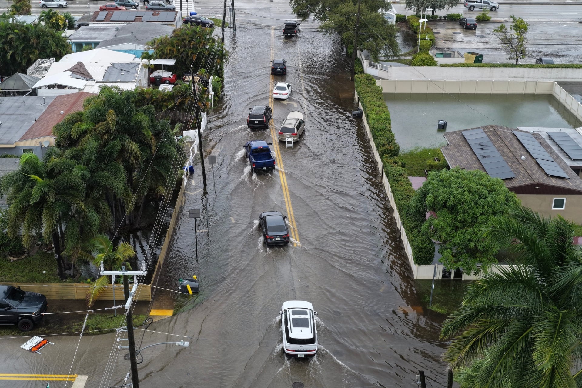
The latest photos and videos emerging from eastern Florida show streets and neighborhoods inundated by knee-high water. Flash flooding has forced school closures, evacuations, and water rescues, though no injuries or deaths had been reported as of 1 p.m. ET Thursday. According to the National Weather Service, showers and thunderstorms should continue through Saturday, prolonging the risk of flash flooding.
“A HIGH Risk (70%+ chance) of excessive rainfall is in effect for Brevard County and the surrounding Space Coast through tonight, worsening ongoing, record-breaking flooding,” the NWS Weather Prediction Center posted on X Thursday afternoon. “Significant flash flooding threatens much of Florida’s east coast.”
A HIGH Risk (70%+ chance) of excessive rainfall is in effect for Brevard County and the surrounding Space Coast through tonight, worsening ongoing, record-breaking flooding. Significant flash flooding threatens much of Florida’s east coast. Never drive into flooded roads! #FLwx pic.twitter.com/d8rEPAw9vS
— NWS Weather Prediction Center (@NWSWPC) November 19, 2026
A wet start to the dry season
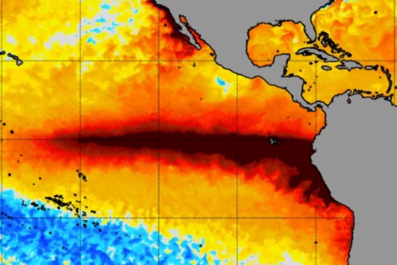
In a typical year, Florida’s dry season begins in October and lasts through the spring, but this is not a typical year. An El Niño of epic proportions has developed and is still strengthening. By some metrics, this event is already considered the strongest on record.
El Niño is the warm phase of the El Niño-Southern Oscillation (ENSO), the biggest source of year-to-year climate variation on the planet. It begins with a weakening of trade winds that pushes warm water from the western Pacific Ocean to the central and eastern tropical Pacific. When water temperatures in this part of the ocean rise, the warming pumps huge amounts of heat and moisture into the atmosphere, altering weather patterns across the globe.
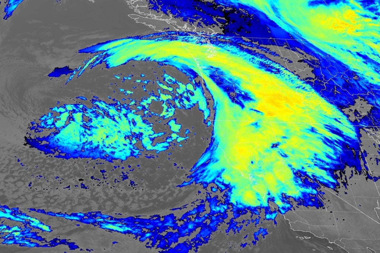
El Niño amplifies the Pacific jet stream and causes it to shift south of its neutral position. This leads to wetter, stormier winter weather across the southern tier of the United States. The jet stream blows west to east over the country, acting like a conveyor belt that carries waterlogged Pacific storms toward Florida.
At the same time, the combination of El Niño and human-driven warming is supercharging atmospheric humidity levels. According to meteorologist Ben Noll, each of the last three months has broken global atmospheric moisture records, and he expects this streak to continue for a year or longer.
“While record global moisture isn’t causing the flooding events unfolding in California and Florida, it is greatly tilting the odds toward more extreme rainfall that can cause flooding,” Noll posted on X Wednesday. “Behind this moisture record sits the strongest El Niño and record-warm global oceans upon the tailwind of a warming climate, leading to more evaporation.”
Forecasters don’t expect El Niño to peak until December, so its strongest impacts on U.S. weather won’t arrive until winter. This almost certainly won’t be the last extreme rain event Florida sees before El Niño subsides, and the rest of the Southeast will remain on alert for severe storms too.